|
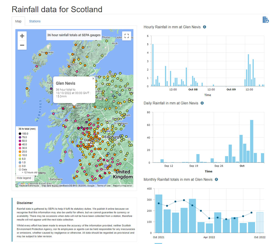
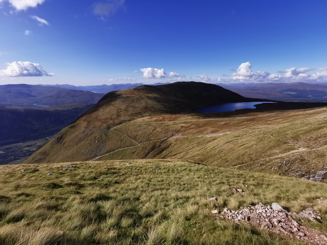
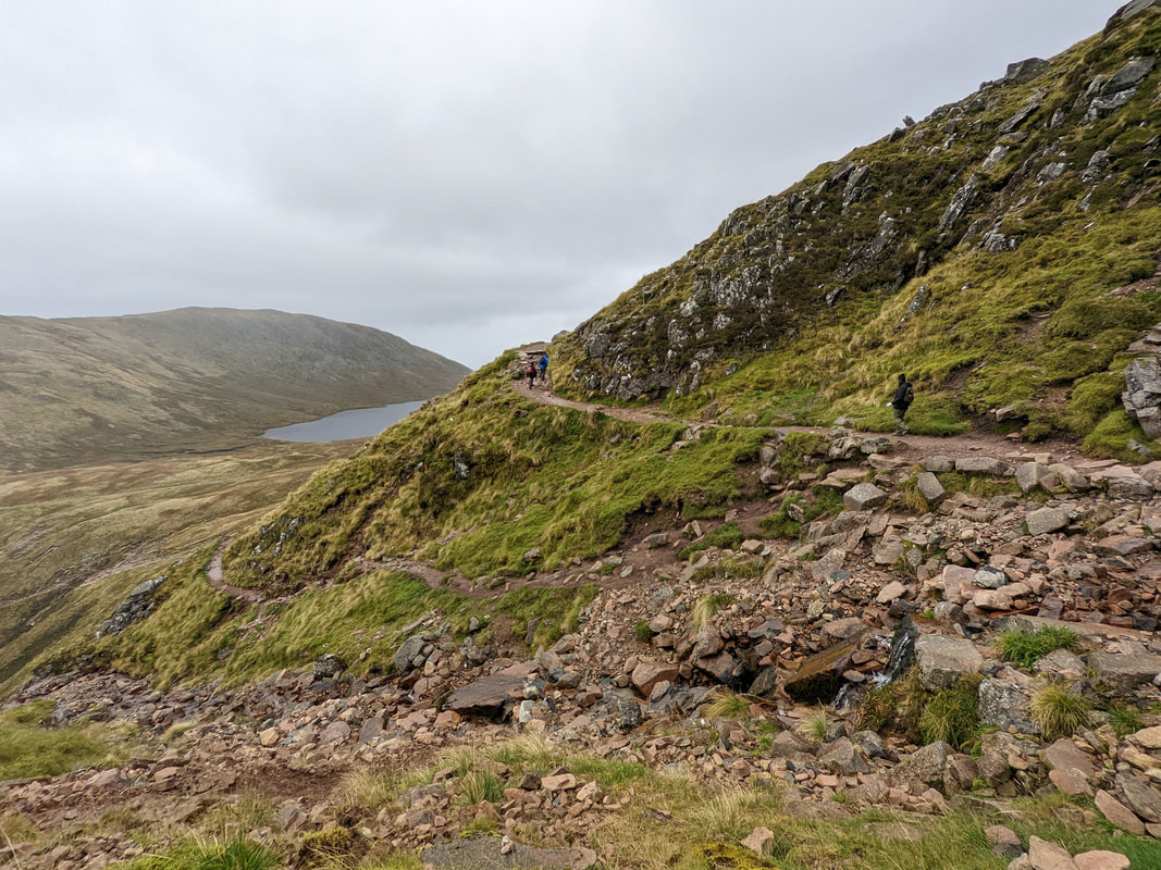
During last week we had a lot of rain. The intensity of the rain peaked at about midnight on Thursday night into Friday morning. There was 67.6mm of rain on Thursday 6th October and in total there was 159.8mm over the four days Monday to Thursday. In one hour (11pm Thursday 6th to midnight) there was 26.2mm of rainfall recorded in Glen Nevis. This is quite a lot, even for Lochaber standards! All of this data is available on the SEPA website here - https://www2.sepa.org.uk/rainfall//data/index/115343 As a result there was a landslide on Ben Nevis which didn't hurt anyone but has resulted in a significant area of ground sliding down into the Red Burn. The slide is easily seen from the mountain path below windy corner. It started on the slope underneath the shortcut path between windy corner and the Red Burn crossing point. This shortcut path has been used more and more over the last couple of years since the signs asking people not to have been removed. On the way down, the shortcut looks significantly shorter (and it is) and enticing to people who just want to get down off the mountain. For most people though, it does not work out well. The shortcut takes longer and crosses very loose, rough and boggy ground. It is easier, quicker and nicer to walk around on the main path. However, we do not know whether erosion on the shortcut path has increased the chance of landslides below it, or whether this would have happened anyway due to the intensity of the rain. Of course, it could be that both these factors combined to make the landslide occur. Either way, we will need to get some experts up there to work this out. One thing is for sure though, we have a very well built path that avoids this area, on which we will not increase the chance of erosion at all, a path that we spent £900,000 on recently (through Nevis Landscape Partnership) that is easier and quicker to walk down and gives better views of the upper part of the mountain. It makes no sense to walk down on the shortcut, so please share this message to anyone who is heading up that way. It is easy enough to reach the people that already know this, but hard to reach the one-time walkers. It looks like similar slides have happened in the past, and if you know of any specific events I'd like to hear about them. There are a few patches of ground where it looks like a slide has occurred and vegetation has grown back over the area.
We were very worried that this would happen on the Grassy Bank that used to be taken by runners in the Ben Nevis Race. This is the steep ground on the other side of the Red Burn. Runners were asked not to use the Grassy Bank by the Ben Nevis Race committee and Nevis Landscape partnership and very few runners have used it since. This total shift in use has allowed vegetation to grow back in this area and it seems to be holding up well. There was no landslide on that side last week. It is clear that more intense weather events will happen as a result of climate change. Heavier falls of rain are one of these things, so we might need to get used to this kind of thing happening more often unless we radically change our behaviour as a worldwide population to something that is sustainable on this planet.
0 Comments
|
AuthorMike Pescod Self reliance is a fundamental principle of mountaineering. By participating we accept this and take responsibility for the decisions we make. These blog posts and conditions reports are intended to help you make good decisions. They do not remove the need for you to make your own judgements when out in the hills.
Archives
March 2024
|


 RSS Feed
