|
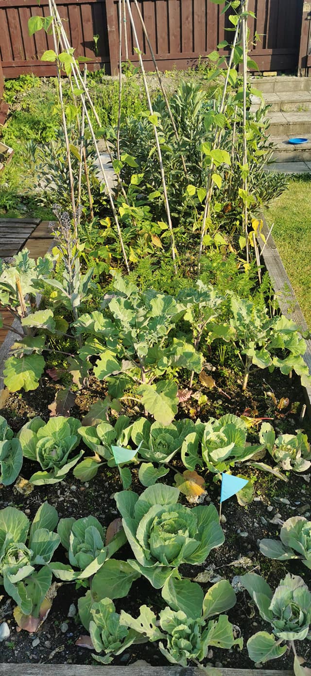
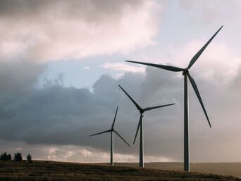
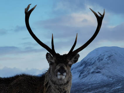
While I was out for a walk recently I was talking about how helpless I feel about being able to do something about our impact on the planet. I feel like I can't do anything meaningful to help reverse human impact on climate change, biodiversity loss, polution, plastic waste and extreme weather events. Our climate emergency seems like such a huge problem it is difficult to see how anything I can do on a personal level will change anything. Why do I bother trying to recycle plastic when there are huge floating islands of it in the oceans and when supermarkets are increasing their plastic usage, not decreasing it. It seems like all the power to change things for the better lies with big corporations and governments. What difference can I make against such a massive problem? The continued thaw and very slow relaxation of covid restrictions probably added to my feeling of helplessness. All the drive from the governments seems to be directed towards getting businesses back up and running, opening up the economy and getting us back to normal, forgetting that normal is what is wreaking havoc with our environment. Once I got home and wrote down some of the things that we can do and how much difference they will make, I started to feel a bit better. It also looks like we don't need to turn into vegan eco-warriors to make a difference (sorry to all my vegan eco-warrior friends, you're all lovely!). Here's what I think we can do. First of all, let's talk about it. Make it normal to talk about issues of climate change, polution and our impact on the planet, as well as ideas of what we can do to help turn the tide. It is a big and scary subject and it is easy to fall into very depressing conversations about the most recent evidence of our destruction of the environment. So, let's talk about what we can do, share ideas and knowledge, make it normal to want to become sustainable as a population, and as individuals. One person's effort is tiny in the big scheme of things, but when everyone makes the same effort the change is huge. Connect with nature. Not just a walk in the woods on a Sunday afternoon listening to a podcast. I mean make a real connection with nature. Doing stuff in nature like biking and climbing is very good but still might not create a real connection. Slow down, look at the details, study how they change through time, note when the snowdrops burst up through the ground, when the daffodils bloom, how many bees you see. Even in an urban setting, there are trees to become friends with, "weeds" (AKA wild flowers) that grow in the most unlikely places pushing their way through tarmac and cracks in the concrete. Learn about habitats, land usage and management. Ideally, grow stuff. Growing your own vegetables is a fantastic way to create a real connection with nature and has the additional benefit of reducing food miles. You can grow herbs on a windowsill, tomatoes on a balcony, potatoes in bags. You don't need very much space at all, but if you do have some garden space make the most of it. The value of garden and green spaces has been highlighted through lockdown so let's maintain that and nurture them. The impact of global climate change and our impact on the planet is seen through nature and our open spaces, as well as changes in weather, especially in extreme weather events. To be able to see these changes and feel how they might impact us on a personal level, we need to have a personal connection with nature and our landscape. It's not surprising that we, as a population, have become completely disconnected with nature when modern lives deliver everything we need and everything we want at a touch of a screen. It's natural to want to make lives easier for us, but ultimately it is not healthy. Our disconnect with nature is a fundamental problem that needs to be tackled. Change banks. Many mainstream banks continue to invest in unsustainable industries such as oil and coal. Barclays and HSBC have collectively invested over £149 billion in coal, gas, oil, tar sands and fracking since the Paris Climate Agreement was signed in 2015, making them the 7th and 12th worst banks in the world respectively, and the two worst in Europe, for financing climate change. By moving our banking to an ethical bank, and writing to tell the banks why we are moving, we can demonstrate what our priorities are and change what investment there is available for different industries. Once you have changed banks (with a seven day switch guarantee) there is little or no impact on you other than knowing that your savings are being put to good use. Have a look at BankOnOurFuture.uk/action Change electricity supplier. Do some research and change your provider to one that generates power from renewable and green sources instead of coal or gas fired power stations. Again, once you have done it, there is little or no impact on you afterwards. You need to do some research though. The best providers are actively investing and building renewable power generation infrastructure while others offer very green looking tarifs which offset their carbon production by planting trees. Planting trees is a good thing but there have been many problems with big carbon offset schemes and ultimately we need more renewable generation infrastructure. Have a look here as a start - https://energysavingtrust.org.uk/advice/switching-your-energy-supplier/ Stop wasting food. Each year, one third of food produced in the world goes to waste, and it is responsible for 8% of all greenhouse gas emissions. This is a stunning statistic and one that horrifies me and puzzles me in equal measure. In my house, we buy what we need and eat it all. There is very little food waste at all, and the peelings and food scraps we do get rid of go into a compost bin and into the vegetable patch. Reducing how much food we waste would have a huge impact on the greenhouse gas emitions we are each responsible for. Research conducted by the Food and Agriculture Organizaton of the United Nations from 2013 estimates that if food waste was a country, then it would be the third highest emitter of GHG emissions. Each year, we waste 1.3 gigatons of edible food and this releases 3.3 gigatons of CO2 equivalent (without taking into account land use change). Buy what you need and make use of produce about to be thrown out if you can. Try this - https://toogoodtogo.org/en/ Eat less meat and be happy to pay more for good quality, locally sourced meat. Check where your fruit and vegetables come from to eat produce grown closer to home, and eat fruit and vegetables that are in season. In Fort William we are lucky enough to be able to buy venison from Jahama Highland Estates and all sorts of produce from local crofts through Food Lochaber . Do some research, you might have similar producers near you - https://www.farminguk.com/ - but remember that local doesn't always mean better. It's hard enough trying to work out what to eat to stay healthy, never mind trying to work out what to eat to keep the planet healthy. Soil is currently being destroyed 10 times faster than it is being created. The UK has lost 84% of its fertile topsoil since 1850, with the erosion continuing at a rate of 1cm to 3cm a year. It's a huge subject and there are no single, straightforward answers. If you want to learn (a huge amount) about it have a look at the Sustainable Food Trust. ‘Kiss the Ground’, currently streaming on Netflix, has huge relevance for the massive environmental and health problems we face today and gives a nicely balanced view on food production. It's a really engaging film, easy to watch, and is highly recommended. Hire kit and don't fall victim to fashion. If you ski for a week or two each year, do you really need to own a full set of ski gear? Would that cupboard in your house be more useful to you if it didn't have all that stuff in it doing nothing for 50 weeks of the year? It's the same with winter climbing gear. It also makes a lot of sense to travel with fewer bags and kit. And just think about whether we actually need a new jacket in this year's colours when last year's jacket is still working well. https://www.scottishmountainhire.co.uk/
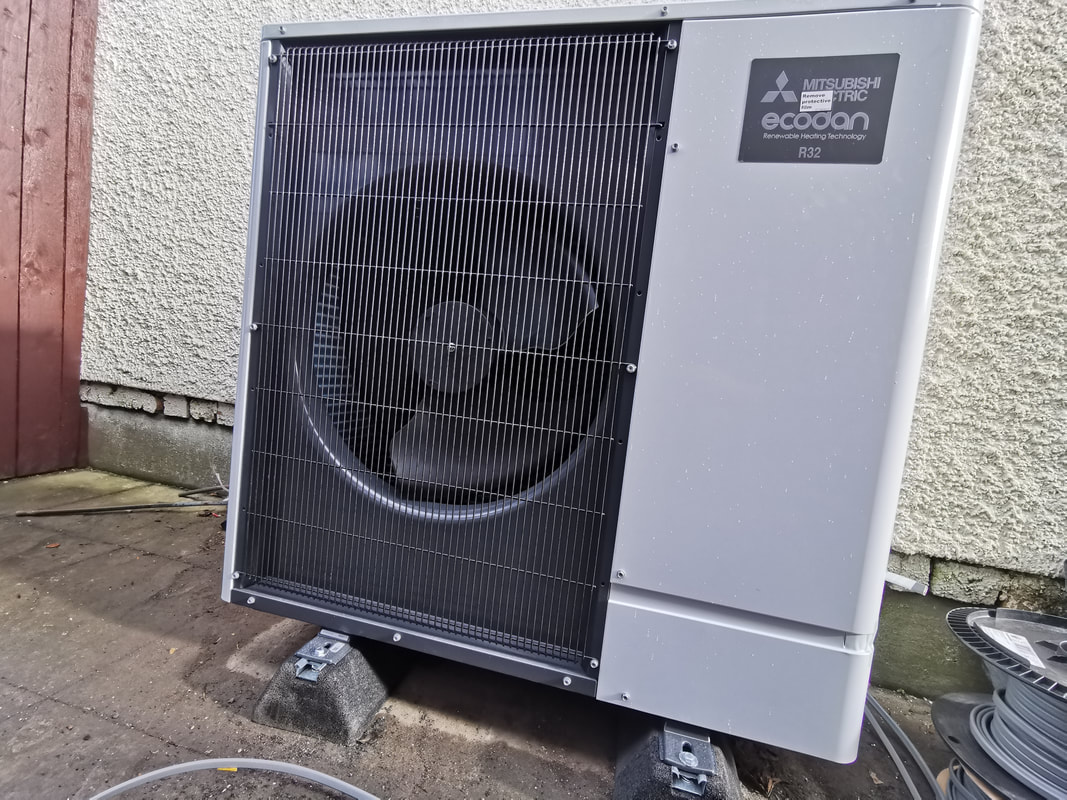
These are all pretty easy things to do that have little impact on your daily life. You can be an eco-warrior without having to look like one! But that's the point, isn't it? We all have to do our bit, it's mainstream, it's normal. Doing something to help the human race live sustainably on this planet is something we all need to do. We can't rely on other people to do it for us. We all need to do our bit. Here's what we are doing as a business to improve our sustainability.
2 Comments
We have had unusually strong and persistent easterly winds for a week now bringing fresh snowfall and creating deep accumulations of snow and a High avalanche hazard in some areas. It has been a very difficult week to get out and do anything safely, so it's a good time to brush up on some more planning skills.
In Scotland, we are super lucky to have the Scottish Avalanche Information Service giving us detailed information on snow conditions and the avalanche hazard. SAIS is funded by Sport Scotland which itself is a Scottish Government funded organisation. The Scottish Government considers this to be an essential service for walkers, climbers and skiers. The people delivering the service are incredibly experienced and highly trained observers and the way the reports are presented is world class. We have an amazing resource here, make sure you know how to use it properly. Pull up the avalanche forecast in a new window and have a map to hand while you read through this.
We need to build a picture of the snow cover and its history. Start by reading the Weekly Snowpack Summary, top right of the page. This describes the previous week's weather and what happened to the snow. It will give some background to what to expect on your day out, where the snow is, how the weather has changed it, and what hazard there is in general.
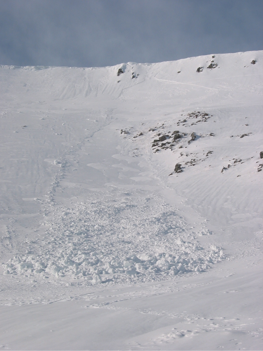
Have a look at the blog posts. On the right of the page, under the Weekly Snowpack Summary, you'll find the last few blog posts rom SAIS observers. These have photos taken while they were out working as well all sorts of points of interest. A photo of where you are going, or somewhere close to it, is really valuable so you know what to expect when you get there. With a bit of an idea of what snow cover there is and its history, we now need more detail. You'll get this in the Observed Avalanched Hazard tab to the right of the Avalanche Hazard Forecast. This is exactly what it says, observed avalanche hazard, i.e. actual data not a forecast. The forecasters go to lots of different places on their day out, making observations of the snow and checking the hazard. This is observed data, the detailed starting point on which the forecast is based. It is occasionally different to what was forecast the day before. Lastly, read the forecast. Read the text and take time to read the details on the avalanche hazard rose. Check the altitudes of the start of the snowpack and where the higher hazard is, as well as what the hazard level is.
So, what does it say? The avalanche hazard rose (AKA the wheel of fortune or the avalanche piechart) tells us where the hazard is and what level of hazard it is. Each aspect of the mountain is represented at different altitudes all the way up to the highest peak in the area of the forecast. You can work out which aspects of slope have less avalanche hazard and stick to those. You need to know what the hazard level is in each area too.
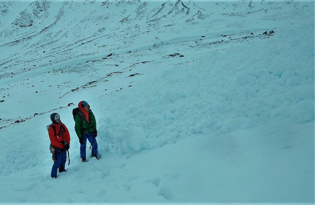
The avalanche hazard scale is available to see by clicking just above the avalanche hazard rose. Take time to read the descriptions carefully and really understand what each level is. The words have been very carefully chosen and developed to give us the information we need in a practical, usable way. The hazard levels described by "Low", "Moderate", "Considerable" and "High" are very specific levels, not just vague adjectives. The descriptions talk about natural avalanches and human triggered avalanches. Natural avalanches are started by a natural trigger such as a rise in temperature or rapid accumulation of snow. Natural avalanches can be triggered above you and sweep down onto you. Large natural avalanches can travel below the area marked on the avalanche forecast rose. It is important to take notice of avalanche paths in case you are in a run-out zone when a natural avalanche occurs. You might be on relatively secure slopes but what is above you might not be secure. Human triggered avalanches are what normally catch people out though. Most people trigger the avalanche that they get caught in. Triggering of an avalanche will occur if the slope is steep enough and if there is enough extra weight on the snow to act as a trigger. In a Moderate hazard, human triggering is possible, but not likely. It's reasonable to cross these slopes with some care. In a Considerable hazard, a single person load is likely to trigger an avalanche. Would you cross the road if you were likely to be hit by a car? Probably not, so don't go walking across steep slopes of this hazard level. Natural avalanches may occur, but are not likely. A High avalanche hazard says naturally occuring avalanches and human triggered avalanches will occur and they could be large or very large. Don't go near the red areas! How steep is steep enough? Anything more than 25° can avalanche, but the most likely angle for an avalanche is about 30° to 45°. Knowing how steep a slope is, is a useful skill to develop. You can start by using a clinometer on your phone or compass, or the tool in the Be Avalanche Aware app from SAIS.
It's time to start looking at a map. We need to transcribe the information on the avalanche hazard rose to the slopes we see on the map. We need to look at the contour lines and work out the aspect of slope and its gradient.
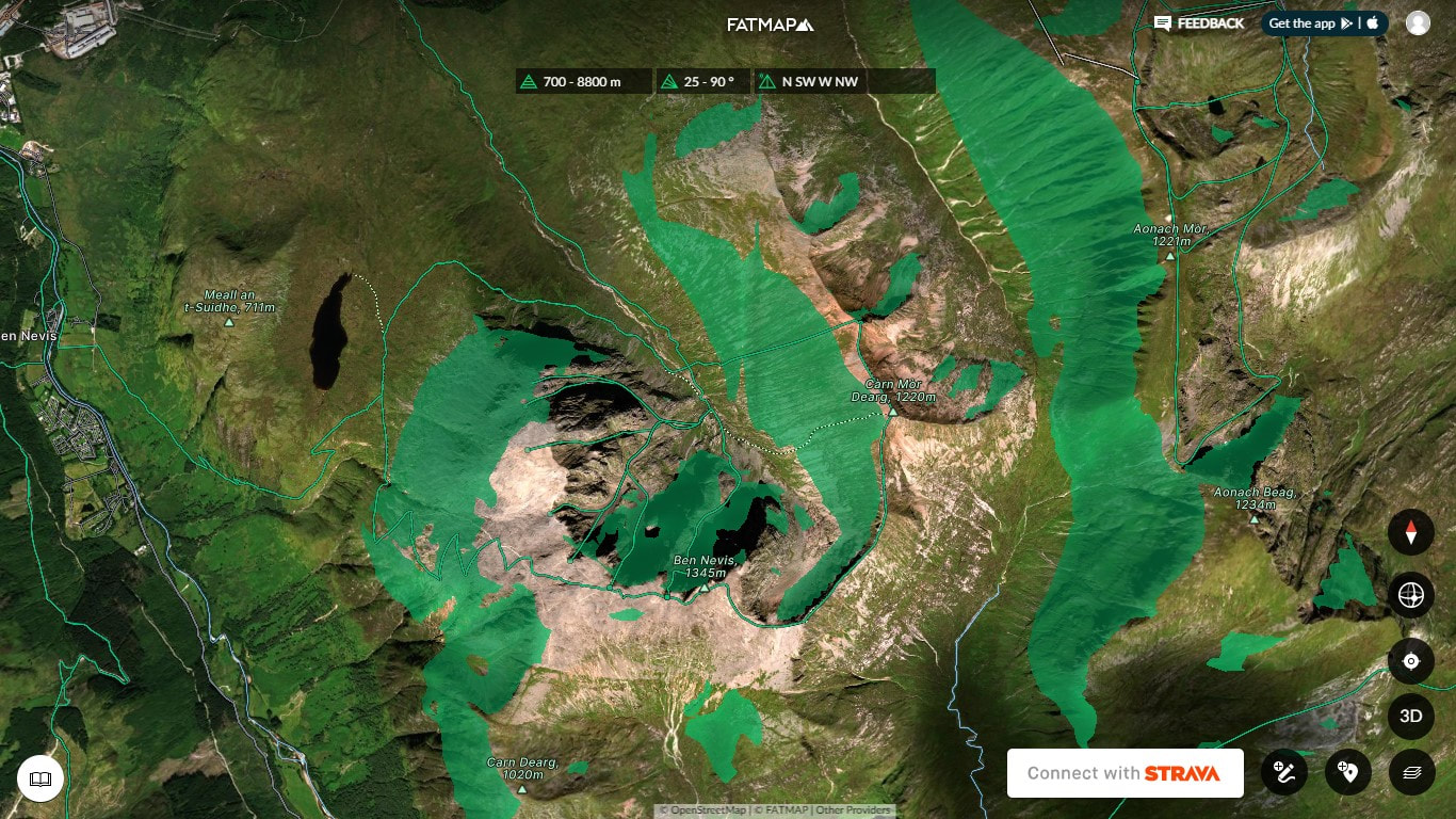
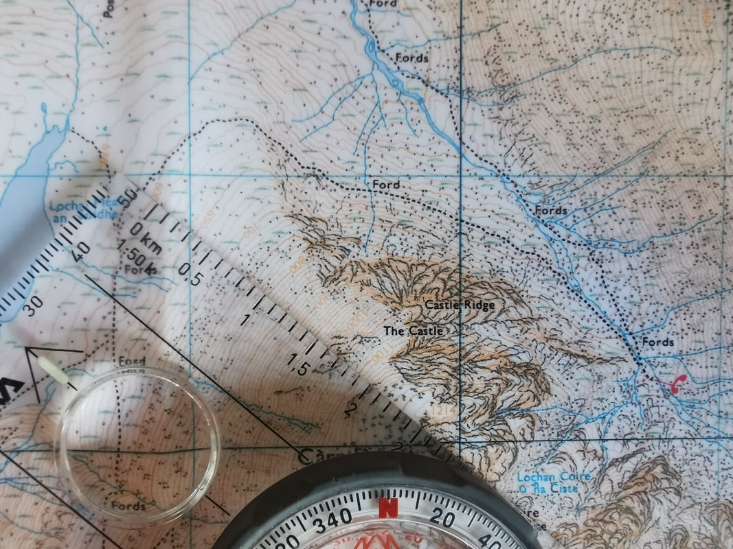
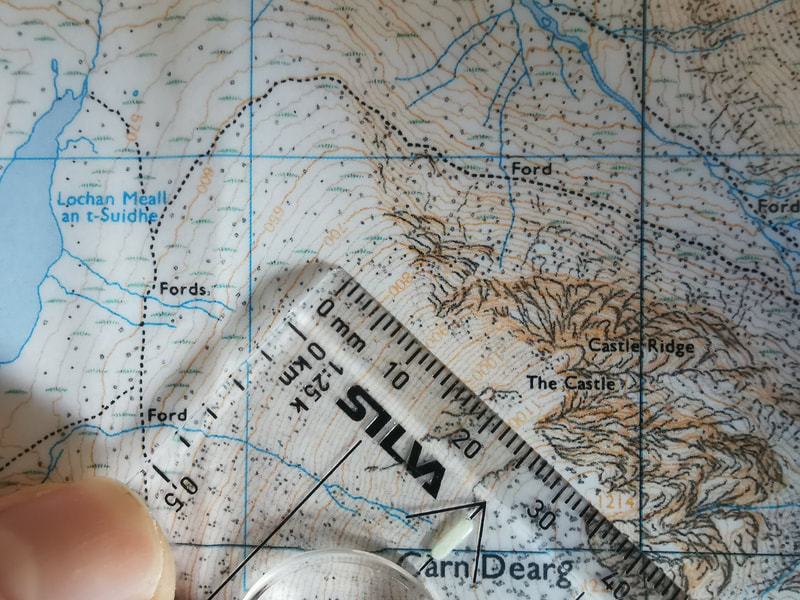
If you want an easy way to do this, use Fat Map. You can add a layer to the satelite image to show areas above a particular altitude, on particular aspects and gradients. In the image above I have selected SW, W, NW and N facing slopes above 700m and steeper than 25°. The green shaded areas in the image relate to the areas of considerable avalanche hazard in the forecast above. You can do the same by looking at the contour lines. The easiest thing to do is work out areas above a certain altitude by finding that contour line. If you stay below this altitude and away from run-out zones, you will be pretty secure. The aspect of slope can be determined by considering a line perpendicular (at right angles) to the contour lines, pointing down the slope. See the image below. We can also work out the gradient of a slope from the contour lines. On an OS map, the index contour lines (the thick ones) are 50m apart vertically. 50m horizontally on a 1:25k map is 2mm. So if the index contour lines are 2mm apart, the slope is 45°. If the index contour lines are 4mm apart, the slope is just under 30° (26.6° to be exact). I'll spare you the trigonometry!
Looking at the forecast above, a good route to choose might be Castle Ridge on Ben Nevis. It faces east and the forecast says that east facing slopes at all altitudes will have a low avalanche hazard because the wind has scoured off all the soft snow. So far, so good.
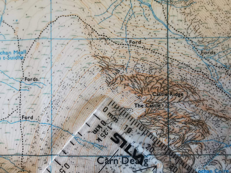
Now think about how to get down. The common descent is down towards Lochain Meall an t'Suidhe. The picture above shows that this slope faces north west and the top of the climb is at 1050m. NW slopes at 1050m have a considerable avalanche hazard forecast for them all the way down to 700m. So, if this slope is steep enough, it is one to avoid. The pictures below show how steep it is. Between the 1000m contour and 950m contour the gap is just over 2mm. So the slope here is close to 45°. If you want to be super accurate, the gap is 2.5mm on the map which is 62.5m in real life. Doing the trigonometry gives a slope angle of 38.7°, just about perfect for triggering avalanches). Down at 800m to 750m the gap between index contours is 4mm making the slope angle just under 30° here, still of concern and to be avoided. So, descending this slope after climbing Castle Ridge is not a good option at the moment. It might be better to go over to the top of Carn Dearg, past Number Four Gully and down the Mountain Track since the slope angle is less all the way down here, the slope stays below 30° under the track all the way to the Red Burn crossing. However, check the gradient of the slopes going from the top of Castle Ridge up to Carn Dearg and decide for yourself if you'd be happy walking up them right now.
So, we can look at the avalanche hazard rose and read which slopes have an avalanche hazard, and how high the hazard is. We can then look at a map and work out what areas on the map to avoid. So, why do we need to read so much on the avalanche forecast instead of just looking at the avalanche hazard rose?
This is because the forecast is just that, a forecast. It is right most of the time, but sometimes it is not accurate because the weather forecast it is based on was not accurate. Sometimes we find an avalanche hazard in a different area or of a different scale to what was forecast and we need to be able to recognise this. If we build up a really good picture of what the snow is like first, we have a much better chance of noticing if the forecast is right or if it is slightly different to what we are seeing. 75% of the decisions we make in a day of mountaineering should be made in advance, based on the weather forecast, the avalanche forecast, our experience and ability level and those of the people we are with. We should think about these things first and choose a route based on them when we are not so easily influenced by what other people are doing or tracks we might see in the snow. Once we are on the journey, walking in to our objective, we should be observing and checking that what we see is in line with the forecast. Most of the time we will be able to stick to our plan, but about 20% of our decisions will be made based on what we see on the journey. By the time we are at critical decision making moments such as which gully to go up or which descent route to take down, we should be 95% sure of the decision before we get there. Being able to see is a very valuable thing. In good visibility we can look for signs that the avalanche forecast is accurate and we can see evidence of instabilities. We should be able to recognise areas where snow has been accumulating, and areas where it has been scoured away. A crucial skill is to be able to recognise windslab under our boots and to be able to spot windslab from scoured stable snow ahead of us. It's nice to be able to see cornices and evidence of recent avalanches, areas of safety and areas threatened from above. If you can't see because you are in the cloud and you don't know the terrain intimately, work on the basis that the avalanche hazard is one higher than the forecast. If it is a Moderate, work on the basis that it is a Considerable, and make decisions appropriately. Many people get caught out by quite small avalanches, small areas of accumulated snow that are just big enough to avalanche and send people tumbling. Big corries full of snow are easy to see, but small areas of windslab in random locations can catch out anyone. The text on the forecast describes some of these locations. Cross loading of gullies and small slopes occurs when a wind blows snow across a slope allowing gullies in the slope to catch snow in the sheltered side of the gully. The avalanche forecast might say that west facing slopes are secure, but in that west facing slope there will be undulations, bluffs and gullies that can catch small areas of windslab and cause individual areas of avalanche hazard. Being avalanched in Scotland is not an option. Burials are quite rare but injuries due to tumbles and the trauma caused by hitting rocks are often severe. We have a world class avalanche information service - make sure you use it properly and fully to help make good mountaineering decisions. |
AuthorMike Pescod Self reliance is a fundamental principle of mountaineering. By participating we accept this and take responsibility for the decisions we make. These blog posts and conditions reports are intended to help you make good decisions. They do not remove the need for you to make your own judgements when out in the hills.
Archives
March 2024
|
 RSS Feed
