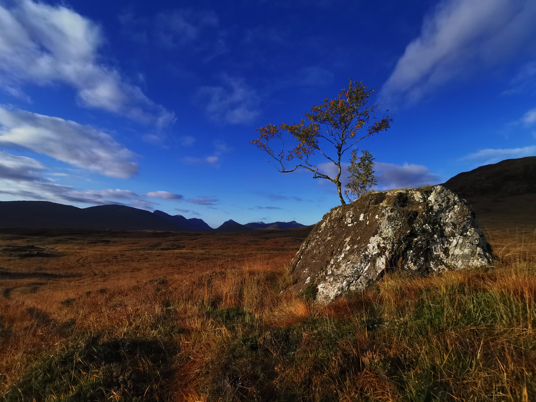
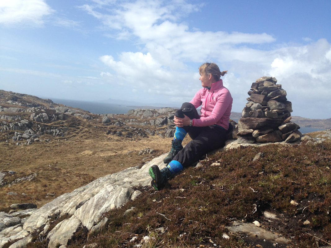
 This time last year I was fairly ambivalent about the two National Parks in Scotland and whether they are effective or desirable designations. Now, I am very much in favour of them, and I am fully in support of a new one in Lochaber. So, what changed? Simply, I have done some research. My thoughts were based on an idea that they are not very effective at changing land management for restoring nature or boosting biodiversity, and there are negative factors such as increased house prices and tourism. But first, did you know that there will be at least one new National Park in Scotland in 2026? That's just three years away and areas that wish to be considered need to nominate themselves by the end of February. The size and scope of any new national park is still to be determined, and several other areas in Scotland will be considered for the designation as well. It is during the process that the size and boundary of any new national park will be decided in conjunction with the communities there. The aims and powers of the new national park will also be finalised in the process. These things will be done in a year long public consultation after the initial decision is made by MSPs about which area(s) should be considered. It is likely that there will be around 6 or 7 areas that nominate themselves for consideration.  So, what are the benefits of National Park status? As we all know, at this time of year Lochaber is overwhelmed with visitors. Traffic grinds to a halt on the clogged roads, the glens, lochs, and coastal beaches are crowded with campervans and tents, bins overflow, rubbish is scattered far and wide for locals and seasonal rangers to clear up, and businesses struggle to recruit and maintain staff due to the housing shortage as ever more homes are turned into short-term let properties. We already have the impacts of a huge number of visitors but we do not have resources and funding to help deliver solutions and infrastructure to manage the impacts of these visitors. Many businesses depend on these visitors, but investment and infrastructure have not adapted to rapid changes in tourism. Visitors are becoming far more mobile in the area and there is a need to fund resources and services to manage increasing visitor numbers. National Park designation can help us manage for our visitors by coordinating resources, supporting the building of infrastructure such as car parks and toilets, and managing a permanent, well resourced, properly equipped ranger service for the whole area.  There is a housing crisis in Lochaber. We do not have enough houses for sale or for rent, especially affordable housing. So, why would we want another hoop for builders and developers to jump through? Scotland's existing national parks try to play a progressive and facilitating role in planning decisions, not an added barrier to sustainable development. A National Park in Lochaber could become the local planning authority for the area or it could "call in" only certain planning applications. Either way, we would have a far more local planning authority with clear aims and objectives laid out in the National Park Plan. National Park Authorities bring together all relevant interests to agree and deliver a shared National Park Plan. National Parks can introduce rules such as requiring more affordable housing to be built and controlling second home ownership. Both of these measures will help with the housing crisis we have currently. 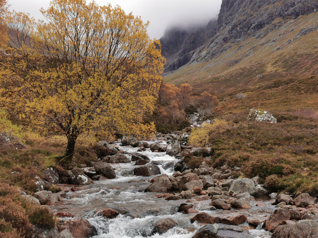 So, that's my initial questions answered, but there are many, many other good reasons to be in support of National Park designation for Lochaber. Cairngorms National Park employs 124 people and receives £12m every year directly from the Scottish Government. Over the next five years it will invest £50m into the area in nature restoration projects. Some examples of Heritage Lottery Fund projects planned by Cairngorms National Park include -
The new Scottish agriculture bill will have far reaching effects on national subsidy mechanisms across 70% of the landscape. A National Park could help the agricultural transition of farms and crofts to low carbon nature friendly farming. Both Scotland’s existing National Parks have actively encouraged further woodland expansion, for example through the Great Trossachs Forest and Cairngorms Connect projects. Cairngorms National Park Authority offers uplift grants for native woodland creation on top of the National Forest Grant Scheme. Will local people be guaranteed representation on the National Park Authority? Yes. At least 20% of the National Park Board’s members are directly elected local people. Of the remainder, half is selected by local authorities within the area (usually our elected councillors) and the other half is selected by Scottish Ministers. There is some more information here - https://nationalparkforlochaber.blogspot.com/ As well as on Facebook - https://www.facebook.com/profile.php?id=100095478254204 It would be good for us all to think about this. It might prove to be a solution to many problems without too many drawbacks. 
0 Comments
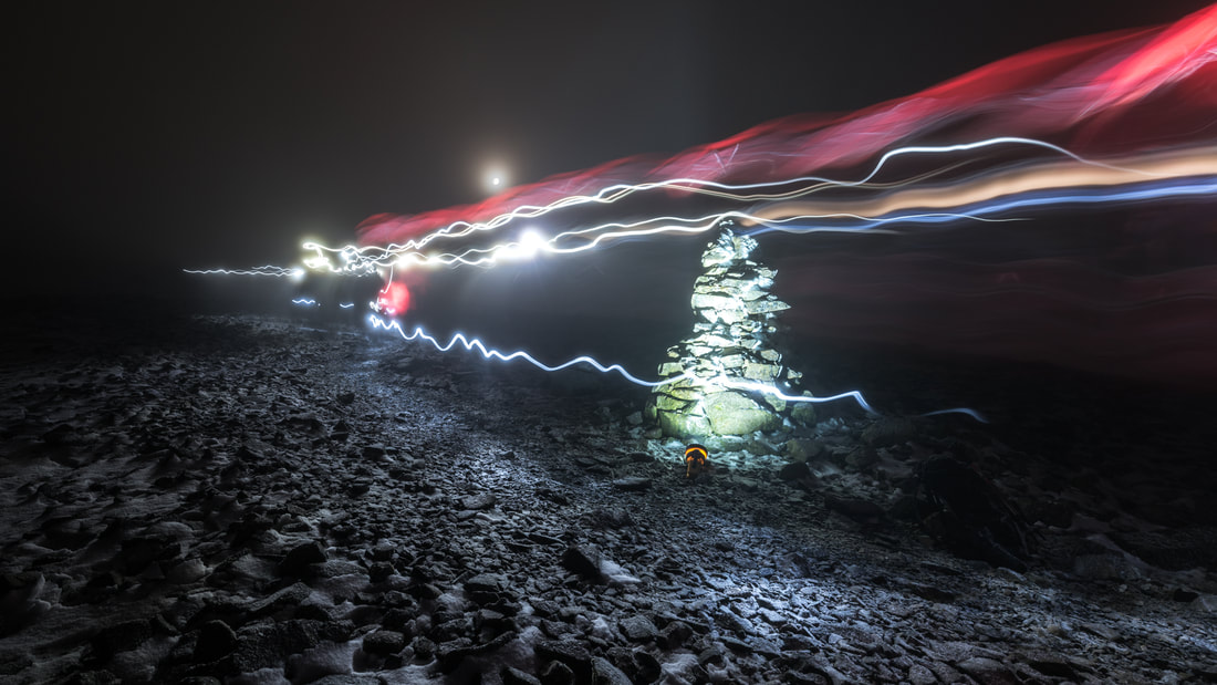 When you walk up a mountain like Ben Nevis, have you ever thought about who maintains the path that you walk on? In fact, who built it in the first place? How much does it cost and where does the money come from? Ben Nevis receives around 150,000 ascents every year so a very big and well built path is essential. Nevis Landscape Partnership and John Muir Trust spent around £1million in the last few years on the mountain path and the ongoing maintenance costs run into tens of thousands of pounds every year. We can't just rely on the landowners to build and maintain trails, after all they can't earn anything back directly to cover the cost. It's not in the remit of the local authority (The Highland Council) and we can't, and don't want to, charge every walker on the path. The burden of building and maintaining mountain trails often comes down to charities, and it's the Nevis Landscape Partnership that coordinates work to maintain the trails in the Nevis area with huge support from the landowners - Jahama Highland Estates, John Muir Trust, Glen Nevis Estate and Forest and Land Scotland. 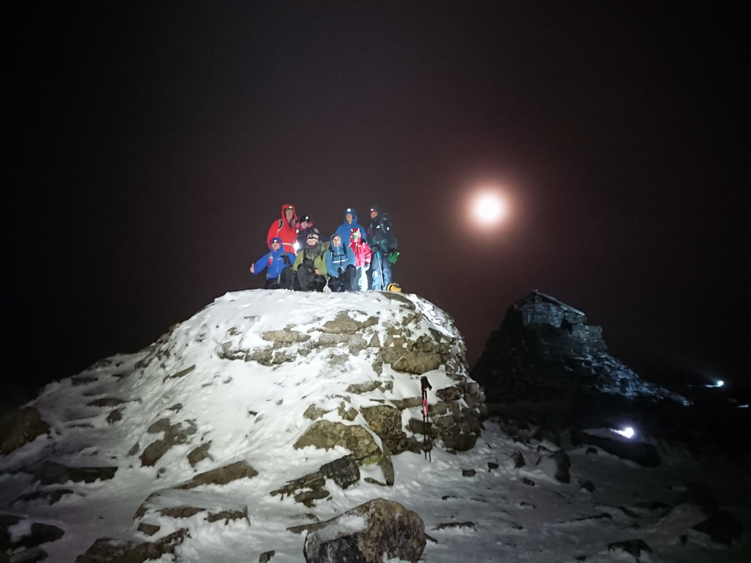 At Abacus Mountain Guides, there's no doubt that we go up Ben Nevis a lot! Mike has been on Ben Nevis well over 1000 times and we really enjoy guiding hundreds of people up and around Ben Nevis every year. Our business is based around Ben Nevis as well as our leisure time. All of these boots on the ground and cars in the parking places have an impact on the landscape and on the people that live in the communities here. So, we want to give something back to the area that we love and rely on so much. We do this in several ways. Mike is a director of Nevis Landscape Partnership, feely giving his time to the running of the organisation. We are members of Nevis Landscape Partnership, Friends of Nevis and John Muir Trust, supporting these organisations that do such good work on the ground. We also pick up litter, plant trees and help on volunteer days. But what they really need is funding. So, we run an annual event called Nevis at Night. 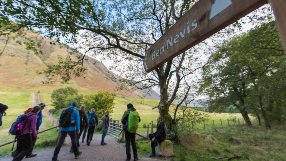 Nevis at Night is an experience of Glen Nevis and Ben Nevis for everyone, and a charity event like no other. Reach for the stars and immerse yourself in the multi-sensory experience during Light up Ben Nevis - our night ascent of the UK's tallest mountain. And it's all in support of The Nevis Fund to carry out essential environmental work in the Nevis area. You can climb Ben Nevis. And you can climb it at night. But this is your opportunity to help light up the entire mountain with a team of like-minded people, while also raising money to protect the very area that we love, as well as a charity of your choice. We head off in the late afternoon on 23rd September 2023 with the aim of reaching the summit shortly after dark. Being on the summit in full darkness is quite an experience which adds another dimension to to the challenge. As well as professional guiding and support, complementary snacks and reflectors, all participants will be able to download a free GPS tracker app which will allow you to check in with your friends as you go. Following the event you can celebrate your achievement with your fellow walkers with a delicious midnight feast back at the event base. 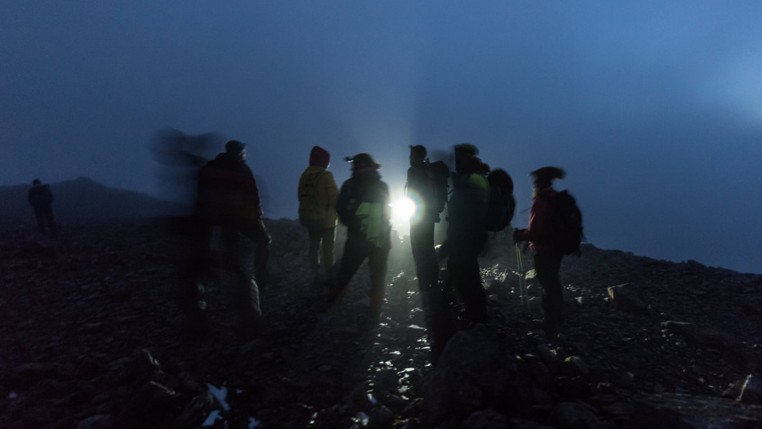 Anyone who is capable of walking up Ben Nevis can take part. Individuals, families, groups of friends or colleagues at work, everyone is welcome.
For Light Up Ben Nevis you have a fundraising target of £250. The cost of participation and in the event is £50 and the other £200 will go to The Nevis Fund to help with essential maintenance and conservation work in the area. If you raise any more than £250 you can choose whether the extra goes to The Nevis Fund or to a charity of your choice. You will have plenty of time to reach your fundraising target as we will ask you to reach certain goals throughout the year: Register - £25 Balance of participation cost - £25 - due by 26th August 2023. Second fundraising target on the 4th November 2023 (six weeks after the event) - £200 + any extra raised that you would like to donate to The Nevis Fund. 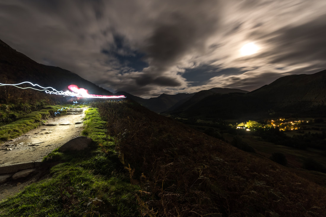 With so many fundraising events taking place on Ben Nevis every year it can be tough to know where your money will be put to best use. This is why we think you should choose to fund raise with Nevis at Night:
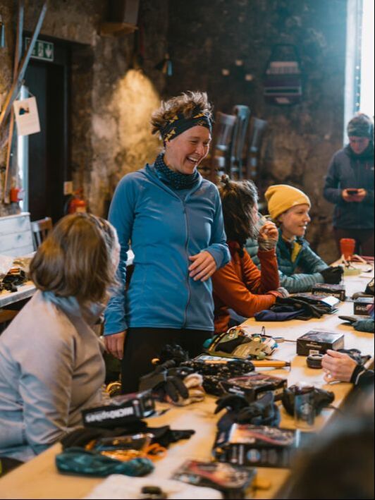
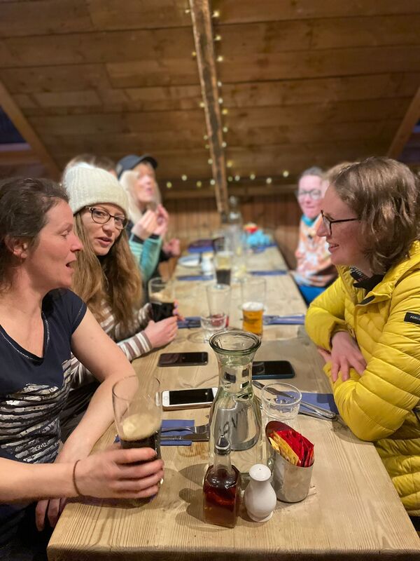
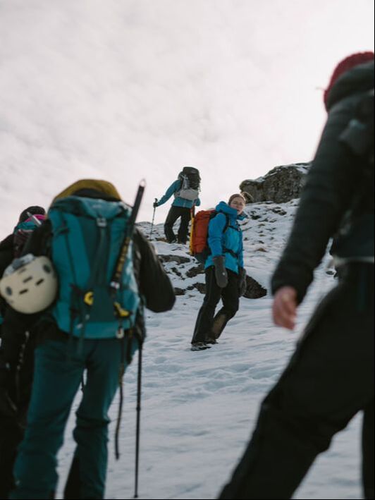
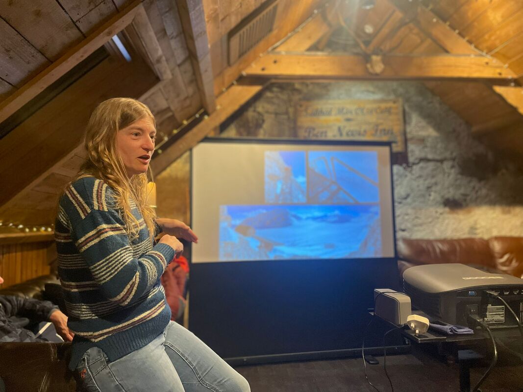
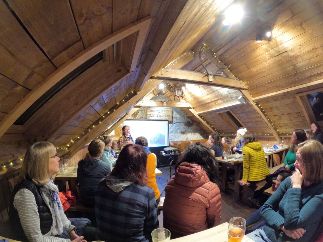
We run the event as a not-for-profit, so you know that all the money you pay to take part goes into running the event. You can sign up now - www.nevisatnight.com/ 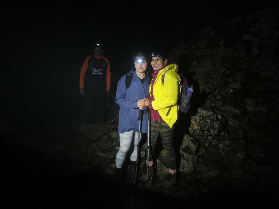 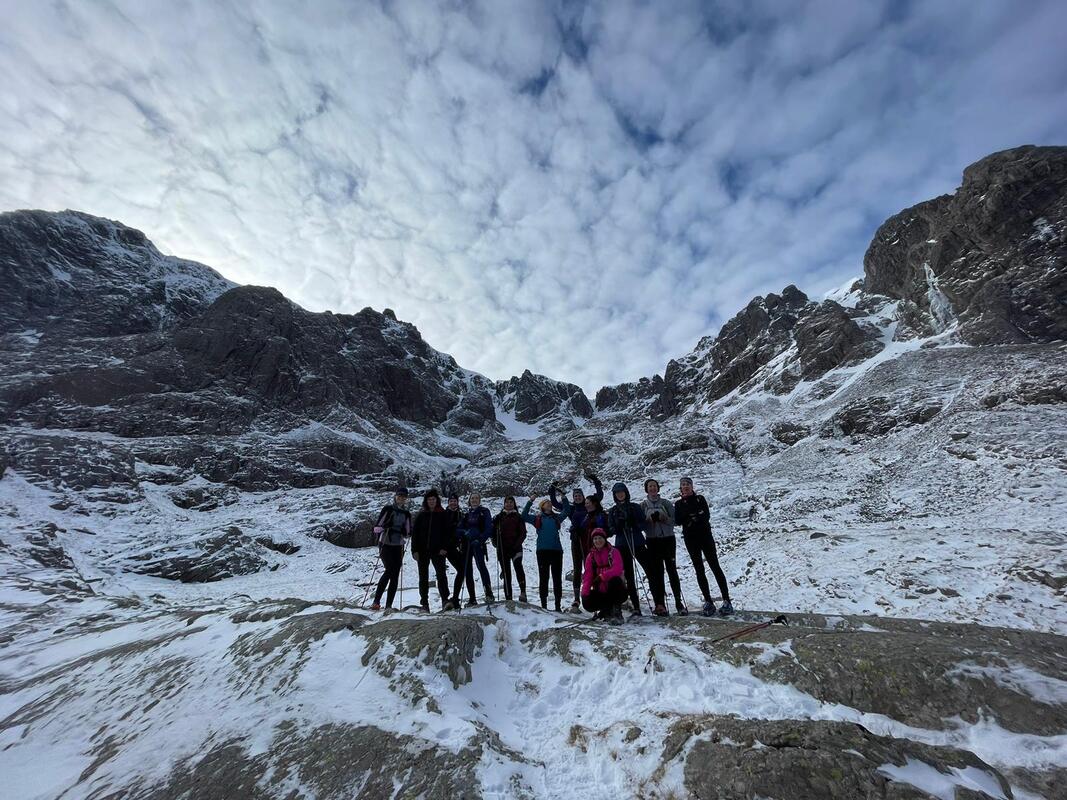 Well that was a top weekend! The Women's Winter Festival with our fab partners Girls on Hills was a real treat. We were blessed with stunning weather on day one and more challenging weather with lots of learning potential on day two! The aims were empowering, encouraging and enthusing women to explore the mountains in winter, and we certainly achieved this! 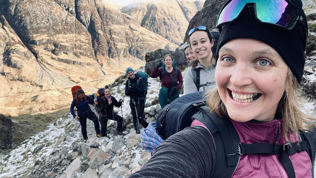 After a winter that has been a bit more miss than hit when it comes to snow and ice cover, we were very lucky to get a return to proper wintry conditions. So much so that, unfortunately, it was a bit tricky to get to Fort William with cancelled trains and tough driving conditions. Nearly everyone made it though and we all enjoyed great days out in the mountains, superb and inspiring talks from our guests and lots of fun and laughter sharing the experience.
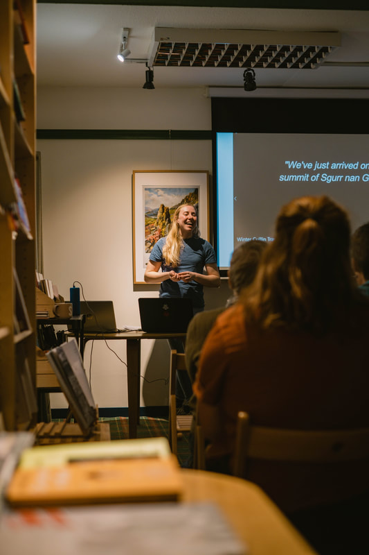
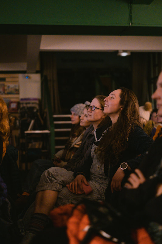
We kicked off with talks from Keri Wallace, trail running guide and Co-Founder of Girls on Hills, who talked about her recent record-breaking Winter Tranter's Round. And Anna Wells, climber, instructor and Founder of Rocks and Trails, who spoke about a few important lessons she's learned from years of walking, scrambling, climbing and even flying in the mountains! It was a packed audience in The Highland Bookshop and the stories from Anna and Keri were so inspiring. There are so many women doing amazing things while also juggling family life and careers, and it was brilliant to hear from two women who have found ways to excel at what they do in so many ways.
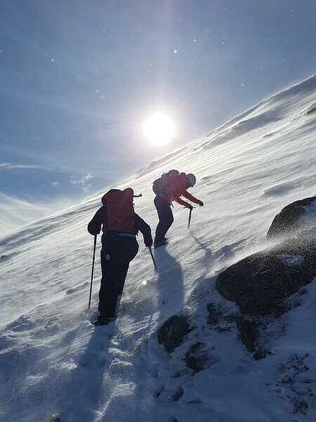
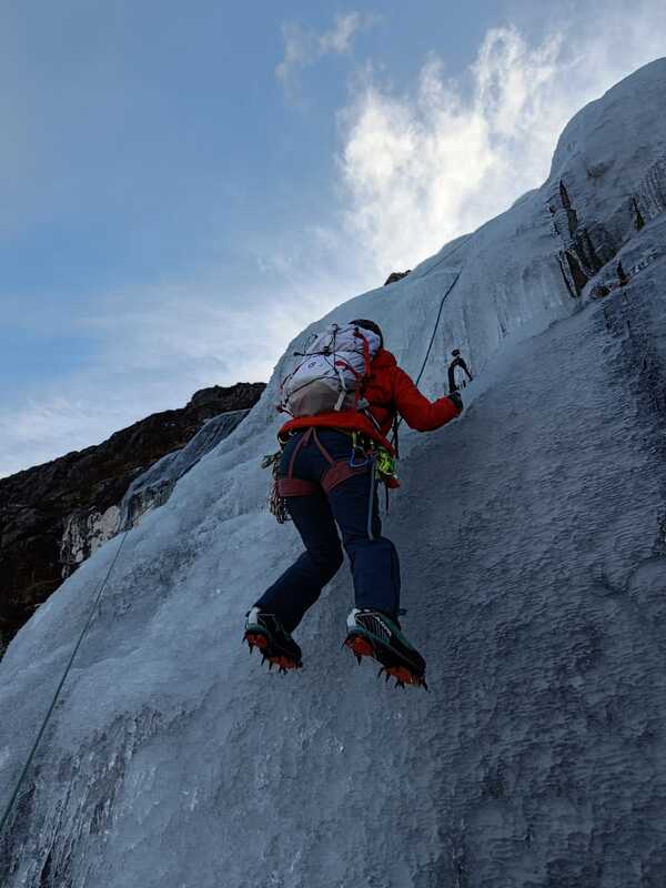
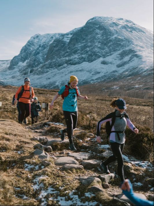
Saturday started sunny and frosty, perfect for getting out on the hills and learning new skills. Running in the crisp, dry air was a delight, and the ground conditions were perfect for the runners to try out micro-spikes and poles during their route that took them over Meall an t-Suidhe, around to the CIC Hut under the North face of Ben Nevis. The run was concluded with some well earned cake at the Highland Soap Company! Winter Walking Skills groups headed to Nevis Range to make use of the uplift to get to the snow more easily. There was plenty of old hard snow to get the crampons into, and to learn how to move around efficiently and securely with an ice axe. The groups learnt about different snow types, kicking steps, ice axe arrests and various ways to use crampons, by which point it was time to get up high and catch the views stretching from the Cairngorms to the Paps of Jura. The climbing teams went to Glencoe where all sorts of snow and ice anchors were practised, along with climbing some brilliant cascade ice. After a very cold week, there was ice in many of the stream lines, some of which make excellent climbs. This low level ice was ideal for focusing on learning skills with minimal walk in required. After eight pitched of beautiful cascade ice the climbers had certainly made the most of the day!
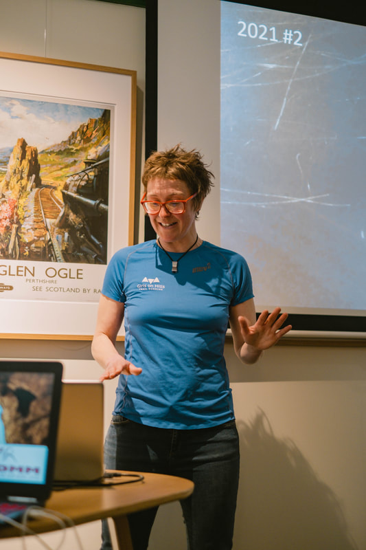
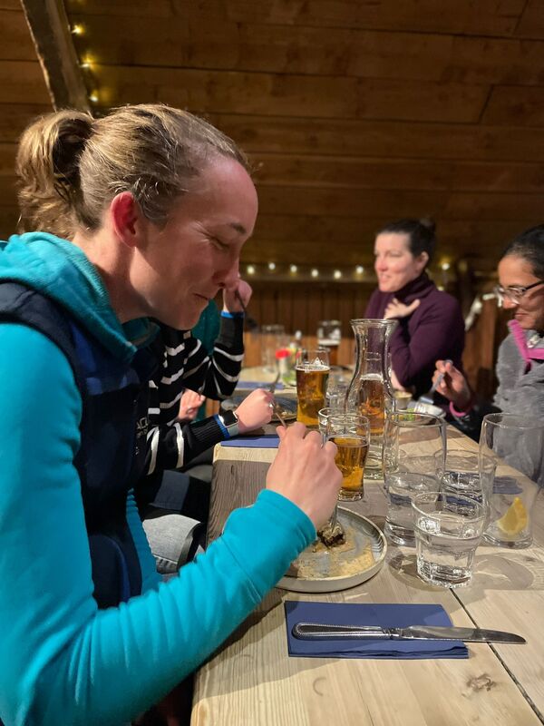
After a long day in the hills, the Ben Nevis Inn served us up a wonderful and very well earned meal. We had lots of people staying at the inn in their new bunk room accommodation which worked out very well. It's a great base for adventures being just outside of Fort William at the foot of Glen Nevis, and right at the start of the path going up Ben Nevis. After dinner talks were from Mountaineering Scotland Safety Advisor Kirsty Pallas and Lou Beetlestone, one of our instructor team for the weekend. Lou stepped up at the very last minute when Marianne Heading, winner of the Montane Yukon Arctic Ultra, found herself snowed in and unable to travel to Fort William! Lou is a full-time outdoor instructor, with a passion for mountain running, climbing and alpine mountaineering. In 2019, Lou was part of the first all-female team planning to climb all the Alpine 4000m peaks, in one summer season and she told us all about her experiences on this project.
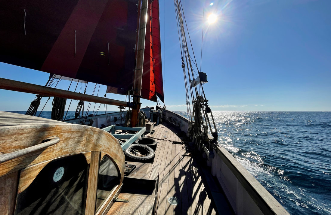
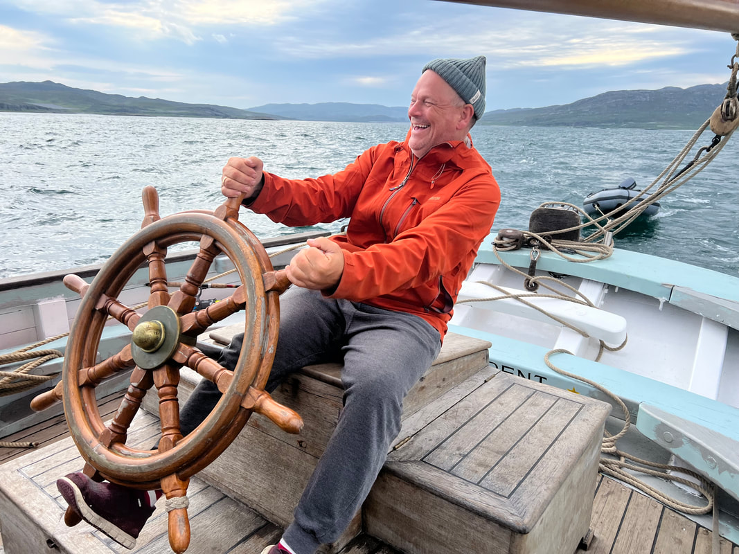
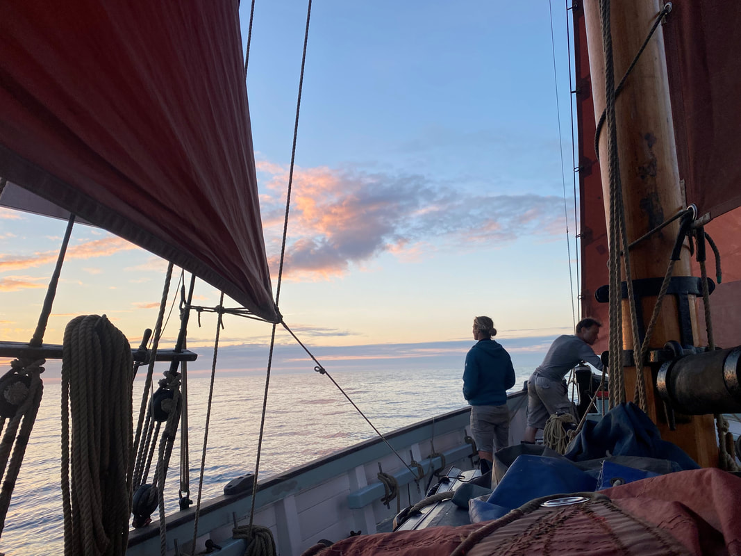
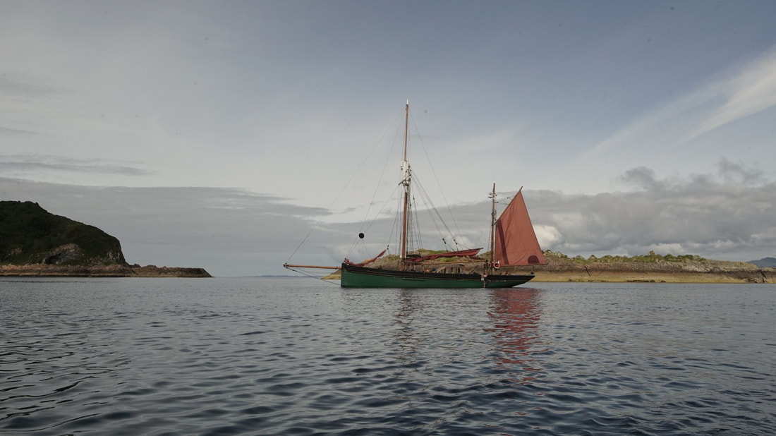
Where day one was crisp and dry, day two was soggy and slushy! We had two very contrasting days, emphasising the changeable conditions we have to deal with in Scotland in winter. It's always useful to learn how to stay warm and dry, even in the wet weather. The poor visibility was ideal for practicing some navigation skills, the climbers found some good snow to learn how secure their snow-anchors are and the climbing on Dorsal Arete was fun even in the rain! Smiles and good company keep you warm even when the weather is wet. The Scottish Highlands in winter can be wild and intimidating, but they can also be awe-inspiring and beautiful. With the right skills and knowledge, you can make these mountains your playground throughout the winter months. This was certainly a weekend of building confidence and having fun, and we will be back next year for more! 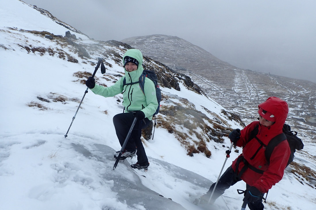 Huge thanks to Hannah Shaw www.Hannah-Shaw.com for taking brilliant images of the weekend and to the Ben Nevis Inn and Highland Bookshop for looking after us all. 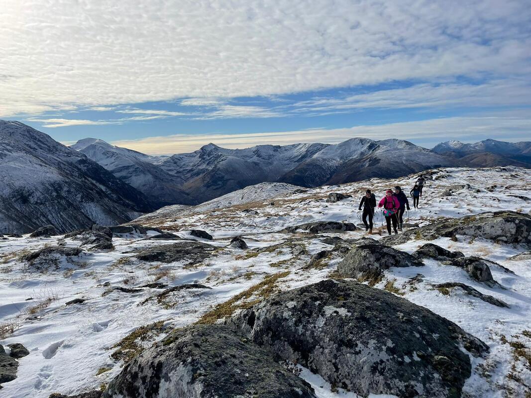 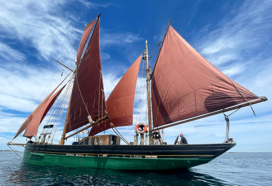 While we have been enjoying great ice climbing in Norway and high on Ben Nevis, the sunny, spring-like weather this week has got us thinking about plans for the summer. We are super excited to be able to announce our collaboration with Morag and Steve who run Provident Sailing. Their boat is a 1924 Brixham Trawler, part of the national historic fleet and one of the most treasured vessels operating in UK waters today. Our aim is to share the experience of being on this amazing boat and enjoy some wild, remote hillwalking. To infuse our guests with our love of sailing and to show you some amazing and beautiful places. At 70 ft on deck, 90 ft overall and weighing in at nearly 90 tons Provident provides a tremendously safe and stable platform. These boats were developed and sailed before the advent of paper charts. Today we have the latest electronic navigation on board but the gaff rig would be completely familiar to a 19th century sailor.
On the 3rd July 2023, Provident will be sailing from Mallaig on a hillwalking adventure amongst the remote peninsulas and islands of the west coast of Scotland. We will guide the team of up to eight people up the hills by day and sail into the evening making sure we get the most out of the land and the sea. Whatever the weather we can promise you a great adventure! We know there is enjoyment in walking for a day with a sleeping bag and food on your back, to spend the night cramped in a flapping tent, always in a rush to beat the midges, before you even start to climb your hill. But on this trip you can sail into remote west coast lochs through magnificent mountains and wild landscape, sleep in luxury cabins with central heating and enjoy the superb cooking of Morag on board Provident, anchored a safe distance away from the shore and the midges! The tender will deliver us to the shore at the foot of the climb up to some of our remotest and most rugged Munros and hills. Heading north and west of Fort William, the tiny roads at last run out; beyond is the famously rugged wilderness region of Knoydart. Even further away and across the sea are the wonderful islands of Rum and Skye with some of the most spectacular lochs and mountains in the UK. 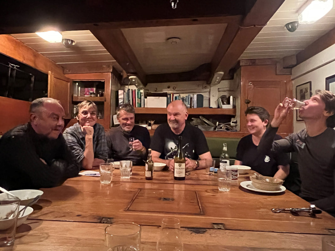 This is an ideal trip if you..
The weather, winds and tides will dictate exactly what we do and where we go, as well as where you would like to go. But possible mountains include..
Meall Buidhe is an incredibly rough and rocky mountain, one of the three magnificent Munros on the Knoydart peninsula. Whichever route is chosen, the ascent requires considerable effort. Regarded by many hillwalkers as amongst the finest mountains in Scotland, Ladhar Bheinn enjoys a superb position surrounded by the sea on three sides. It has dramatic ridges, huge crags falling into Coire Dhorrcail and amazing sea and mountain views from the summit. Beinn Sgritheall gives a steep and punishing ascent; the effort is well worthwhile however as this is one of the finest viewpoints in the Highlands, with a fantastic outlook over dramatic Loch Hourn to Knoydart and the Cuillin of Skye. Rum is magnificently wild and rugged, dominated by the towering mountains of the Rum Cuillin - a miniature version of the Cuillin of Skye. The ridge traverse of the Rum Cuillin is one of the classic Scottish hill days, with plenty of scrambling though the peaks are less technical than the Cuillin of Skye. Diminutive Sgùrr Na Strì on Skye may only reach 494 metres in height, but it's proof that - when it comes to mountains - size doesn't matter. Many walkers reckon that the view from the summit - over Loch Coruisk, the Cuillin and the sea - is the finest in all Britain. 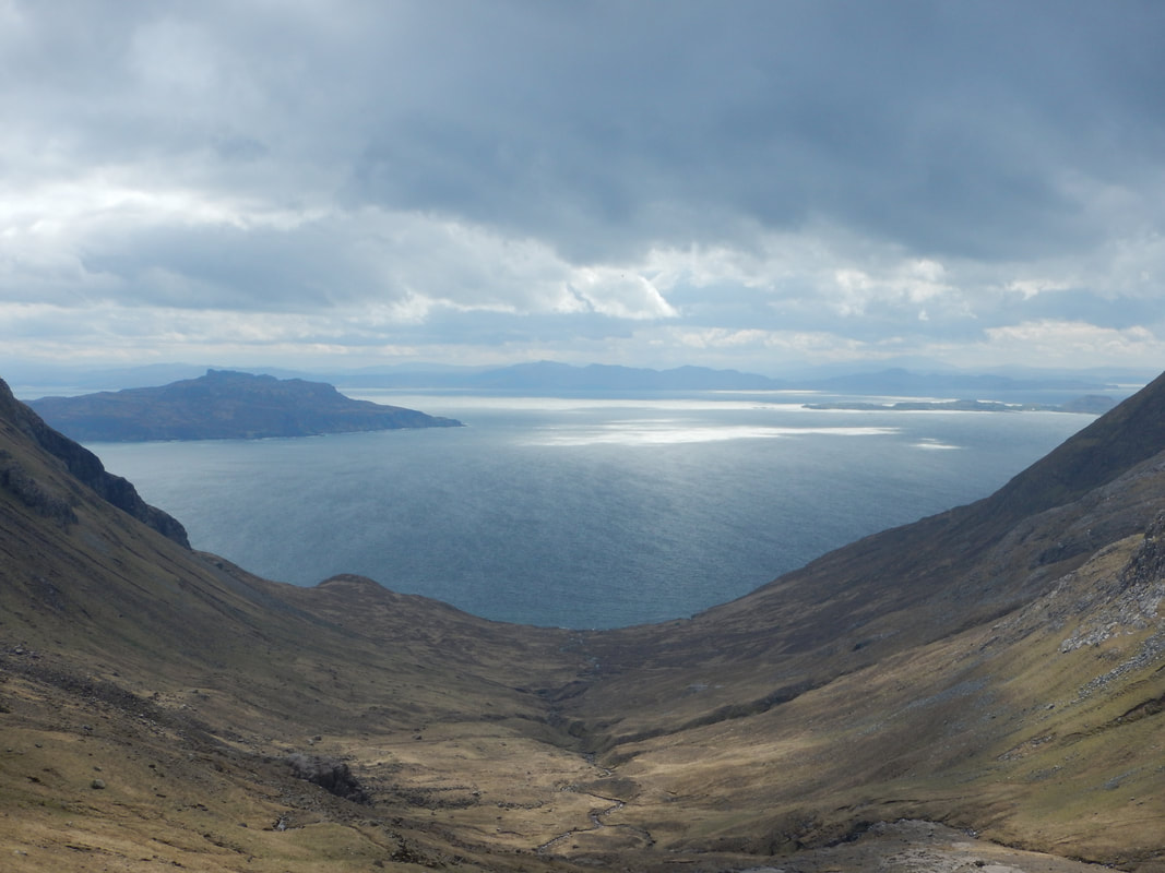 Approach the mountains from the sea, return to the comfort of Provident. We’d love to have you aboard! Price £1310 (sharing a twin cabin) includes six nights on board full board plus guiding on the mountains with Sally, our chief mountain leader, highly experienced and qualified International Mountain Leader. Please get in touch with Provident Sailing and book directly through them. They will take care of the booking process and make sure you are ready for your trip, and we will see you on board! 3rd to 9th July 2023 6 nights, Mallaig to Mallaig £1,310 per person (based on two people sharing) Confirm your place with a £327.50 deposit 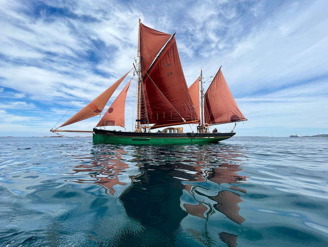 Yesterday I climbed one of the best ice climbs in the world. It's called Kjorlifossen in Rasdalen, Laerdal, Norway and it is 400m of climbing at grade V (Norwegian) and WI5/5+. It's not just me saying that it is one of the best in the world, but Guy Lacelle. Guy was certainly one of the best ice climbers in the world and he travelled and climbed extensively. Before he died in 2009 he compiled a list of what he considered the best ice climbs in the world, and this list contains Kjorlifossen. Clearly the list is one person's thoughts and incorrect since there are no climbs in Scotland in the top 135 climbs in the world. But it is a very good list of world class ice climbs. And I have now climbed one of them. 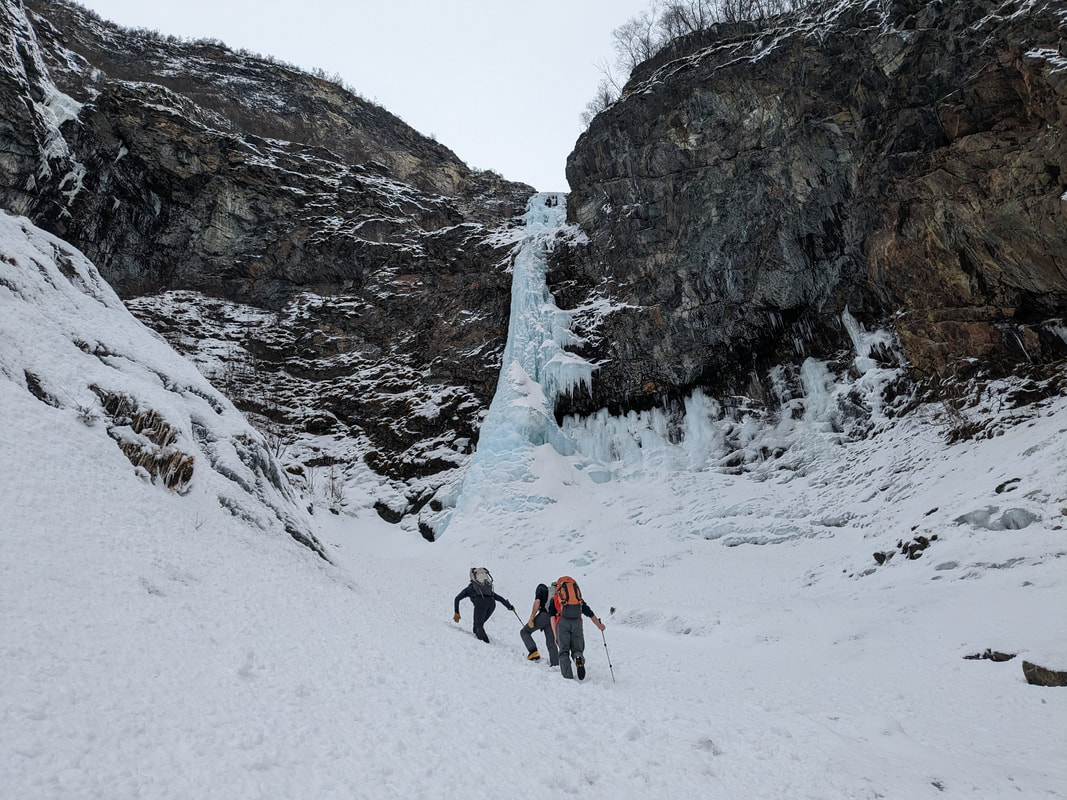 This all sounds a bit boastful but I really don't mean it that way. It's hardly newsworthy that a middle age man goes and climbs some ice in Norway, even if it is a notable climb to those in the know. After all, I have nothing to show for it apart from tired arms and a smile. Inwardly though, it means the world to me. The best bit is that I spent a wonderful day with three friends, sharing a fantastic adventure in a beautiful part of the world. Donald, Dave, Guy and I were all buzzing with excitement at the scale of the climb, its grandeur, the unknowns of the route, the formations of the ice and its quality. Drawing deeply on our combined experience and technique we unravelled the pitches one by one, carefully considering each step, each swing of the axe. At every stage the excitement grew, the view got more expansive, the climbing bigger, better and more outrageous. 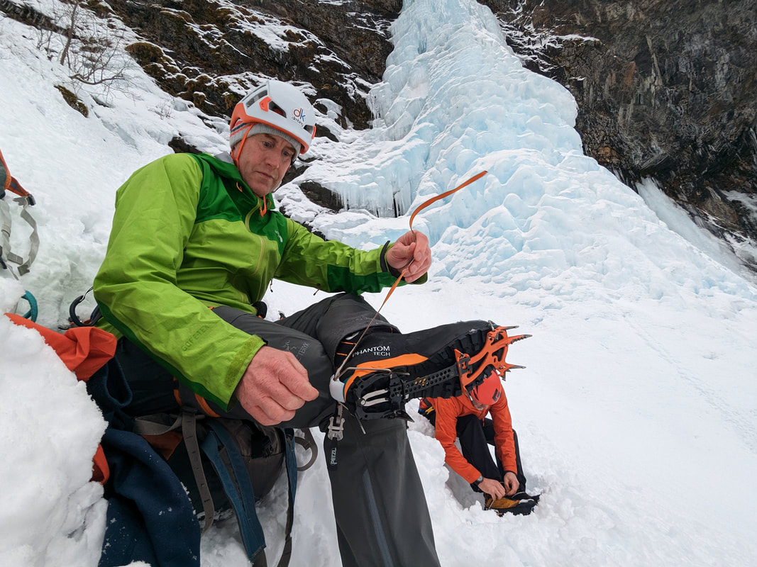 As with any adventure, it had its uncertainties and challenging moments. Like when the base cone of the initial pillar cracked in a stress fracture as Donald and I climbed it, creating a crack about 20mm across that wrapped much of the way around the whole thing. It was like a shot being fired from a gun right in front of us with a sensation of movement in the ice we were climbing on and hoping was solid and stable. I was committed anyway so I continued and Donald did the same. We carried on with minds focused on the climbing, trying to ignore the thoughts of "what if" and trying not to hold on too tight. 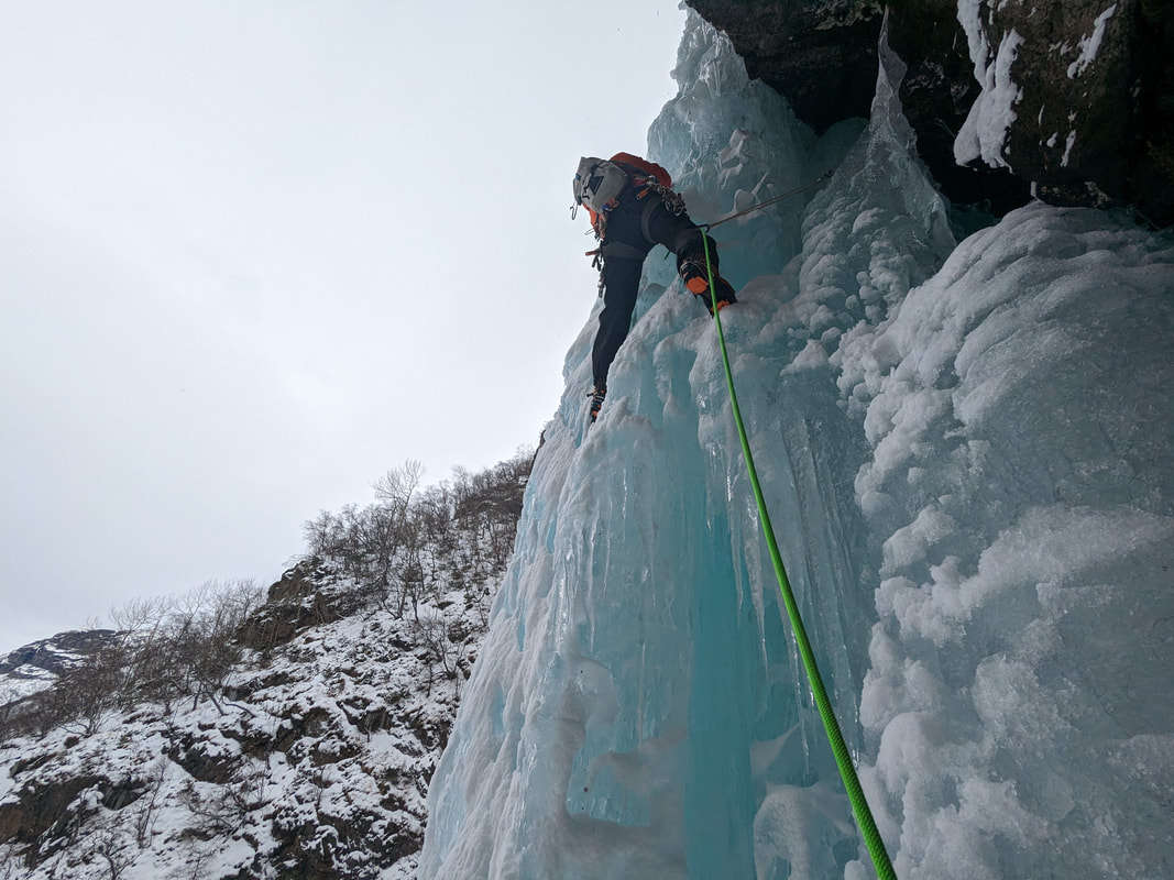 We worked well as a team, each one of us knowing what we needed to do and getting on with all the little jobs, keeping each other right, looking out for each other. We climbed up in two pairs, one on the left, one on the right so that we didn't knock ice debris on each other. We came closer together as the top of the climb narrowed to the exit and we were careful to wait for each other to be well out of the way before climbing. We had one rope in each climbing pair so we came together to abseil on two ropes as a team of four. This had the potential to be pretty awkward and slow going, but we managed it smoothly and quickly despite some hanging belays on the way down. There is a real satisfaction in being able to manage the ropes competently and efficiently. 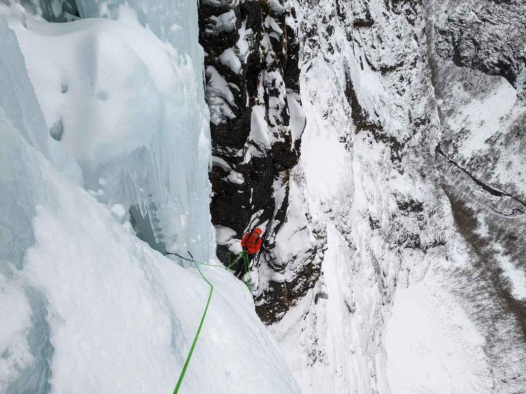 Inwardly for me, this climb meant a lot. For whatever arbitrary reason, I decided that this was the standard and scale of climb that I aspire to. It was the right challenge for me, hard enough, long enough and requiring a big effort mentally and physically. Other climbers have done far harder climbs, longer climbs and many more of them, but I am not comparing myself to them. I am comparing myself to the standard that I wanted to achieve, and I have met my own standard. So, what I am sharing is not so much about this particular climb and its standard, but that I have achieved one of my goals and I'm delighted. I am totally made up, super happy, still smiling and very satisfied. This is what I hope we can all feel. One major part of climbing is about challenge, trying hard physically and mentally to achieve something. The goal isn't so much about the climb, the grade, the standard or the status of the climb. The goal is, or should be, one that you set for yourself that is the right goal for you. Don't measure yourself up with other people, measure yourself up with the goals you want to achieve. So, thank you to Donald King, Dave Rudkin and Guy Buckingham for making this possible for me. It was emotional. 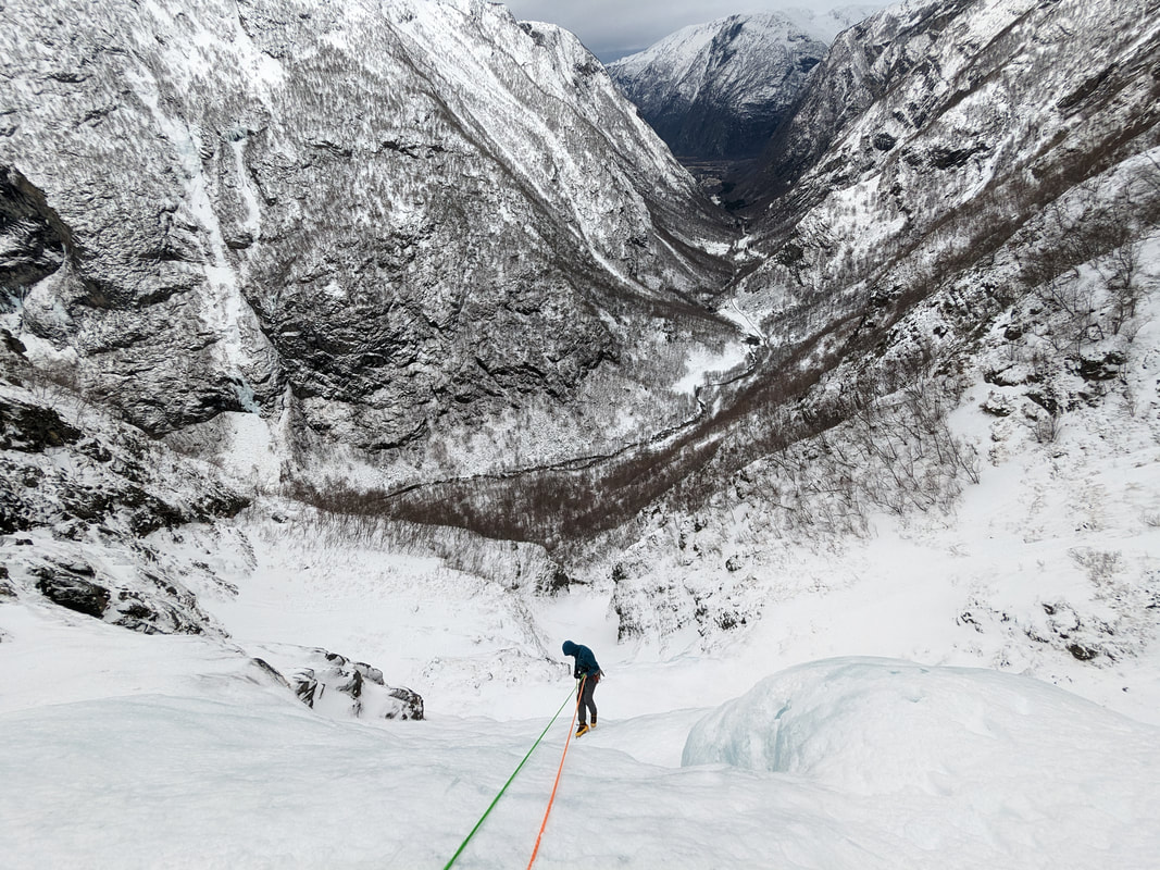  Sitting here in Fort William, looking out of my window at rain falling on the summit of Ben Nevis in the middle of February makes me very sad. When I moved to Fort William 27 years ago we had some very snowy winters and some very poor winters for climbing and skiing. But even the poor winters back then were nothing like we have been experiencing in the last few years. Climate change is certainly making a very clear impact on the volume of snow we get as well as the depth and duration of the thaw periods. For the entire time I have lived here I have enjoyed very regular days out in the mountains that surround Fort William, and especially Ben Nevis. When I first moved here I did not intend to stay here for good. It was a means to an end, a place that I needed to live to get the winter climbing experience that I needed to gain the British Mountain Guide qualification. I was close to moving to the Alps, to France or Switzerland, or even to Canada. However, having lived here for a few years and thinking about where I wanted to raise my family, Louise and I decided that we should stay. We had already developed a real connection with the community and the landscape here, and we did not want to lose this. Over the years since, my connection with the landscape of Lochaber has strengthened to such an extent that I care very deeply about it. I cherish my time in the mountains and wild places of Lochaber, I have a relationship with them and I am learning how the natural systems work. I also notice the changing seasons every year, and the changes between the years. There is no doubt that change is happening.  It is very difficult for each of us to recognise long term changes when the weather and ground conditions have always been so variable and changeable. For many years I said that it is impossible for us to see any long term climate changes because our memories are short. This is still true but the changes are now so obvious that it is hard to miss them. In addition we have very good weather data from stations on Aonach Mor (within Nevis Range ski area) which show the same conclusions. We get occasional updates through the SAIS Lochaber Blog including this one from a couple of week ago - https://lochaberblog.sais.gov.uk/2023/01/a-wet-thaw/ Of course we also have just about every climate scientist on the planet telling us that climate change is happening at an alarming rate and that we must do everything we can to slow it down. Last year 2.1m people in Pakistan were left homeless because of floods that covered 10% to 12% of the land area of Pakistan. The floods affected 33m people. Imagine half the population of the UK being affected by floods all at the same time and you will get an idea of the scale of the crisis they faced due to heavier than usual monsoons and greater glacier melting due to climate change. Here in the UK (and in the rest of Europe and North Africa) we experienced a record breaking heatwave with the highest temperature record of 40.3°C being measured on 19th July. It was declared a National Emergency after a red warning was put in place by the Met Office.  Just a few days ago, Shell reported record annual profits after energy prices surged last year following Russia's invasion of Ukraine. Profits hit $39.9bn (£32.2bn) in 2022, double the previous year's total and the highest in its 115-year history. All of the oil companies plan to spend millions of dollars every single day from 2021 to 2030 on new oil and gas projects which will release 646 billion tonnes of CO2 emissions. The global carbon budget for having a 50% chance of keeping under 1.5°C rise is 500 billion tonnes. Norwegian oil giant @Equinor just announced record profits of £62,000,000,000. That’s more than double what they made last year and the highest EVER in Equinor’s entire history. Despite Equinor’s green rhetoric, this very same company wants to develop an oil field that will create as much emissions as the 28 poorest countries do in a year. If Rosebank is approved, Equinor and partners are set to receive more than £500 million in tax breaks from the UK government to develop the field. So, if the oil companies continue with their plans, we will far exceed the CO2 emissions we need to keep under to maintain some kind of limit on climate change just by themselves. This does not include all the other emissions of CO2 we produce in other ways.  So, what can we do? The first thing to do is to learn the facts about the problem. Recently, I did a Carbon Literacy Course delivered by Protect Our Winters and I highly recommend it. Carbon Literacy Training is designed to give anyone an awareness of the carbon dioxide costs and impacts of everyday activities, and the ability and motivation to reduce emissions on an individual, community and organisational basis. From a position of knowledge we can act and discuss the issue far better. I now understand what my personal emissions are, where they come from and how I can reduce them. Next up, think about your banking, savings and investments. While we are out climbing and skiing, our savings and investments (in our banks and pension funds) are possibly going towards oil and gas projects. You need to check if your money is being used for projects that you are happy with. Have a look at Bank On Our Future to find out more. Changing bank is easy and free, and using a different bank will have little impact on your life but it could have a great impact on our future. Then think about checking whether your local council has its pensions invested in the right place. Despite 75% of local UK councils declaring a climate crisis, they collectively hold investments of nearly £10 billion in fossil fuel funds. The money that’s meant to be securing our future, is destroying it. But you can change that by writing to your council and asking them to change this. Have a look at the Protect Our Winters Divest The Dirt Campaign.  “Is this safe?” was the question asked of me as we descended Mont Blanc. At that moment the person I was with needed reassurance, not an assessment of the hazards, their associated risks and management. So, I said “Yes, totally safe”. This was a lie of course, descending Mont Blanc is never totally safe, mountaineering is dangerous and there are inherent risks. We got down to the Aiguille du Midi and took the telepherique down to Chamonix, an experience that was, to my client, more terrifying and seemingly less safe than climbing Mont Blanc! All this got me thinking about what is safe, how safe is safe and how safe should we try to make climbing? It seems to me that the goal is not to make climbing as safe as possible. The goal is to make it safe enough. There are risks in everything that we do, and there are certainly risks involved with mountaineering and climbing. It’s good to try our best to reduce the risks through training and equipment, techniques and good planning, but there will always be some risk and accidents will happen. In the event of an accident, we should not necessarily change things and put safer systems in place so that kind of accident can never happen again. If we do this, we will eventually change the activity so much that it will not be climbing anymore as we know it.  We do need to learn from our mistakes, self-reflection and peer-reflection are very important, and many accidents are made through mistakes that could have been avoided. However, there is an end point at which we need to accept that certain accidents are inherent in the activity, and need to be accepted (or we don’t take part in the activity). There is a very good analogy between climbing and driving on the road. There are many rules and ways of driving that make it safer, but it is certainly not as safe as possible. If the speed limit was 20mph everywhere, or if we had dual carriageways everywhere, there would be far fewer accidents. However, we have decided that driving is safe enough and we have accepted that a certain number and type of accidents are inevitable with the current system that makes travelling by road feasible. The gold standard we are trying to achieve is to know that what we are doing is safe enough, as safe as it can be while still allowing us to go climbing. This is actually quite hard to do because the feedback we get is not always very helpful. When we go and do something, it might work out nicely, but we might be unaware that we were very close to having something go wrong. I have seen many climbers operating with pretty sloppy ropework but they have never had a problem and have always received positive feedback from their techniques, in the form of not having an accident and going home in one piece. 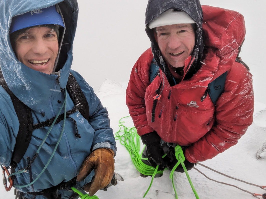 This is especially the case in avalanche terrain. It is possible to walk or ski across a snow slope and think that we made a very good decision about the stability of the snow based on the fact that we did not cause an avalanche. However, we might have been very close to triggering the slope to avalanche. The feedback is either trigger an avalanche or don’t trigger one. We can get positive feedback (no avalanche) when we should have got negative feedback (we were very close to triggering an avalanche). What would be useful is feedback that is not binary (did or did not avalanche) but graduated (we were 95% of the way to triggering an avalanche). Unfortunately, this kind of feedback is not available. Feedback on an individual level can be quite unreliable. However, feedback on the level of the entire climbing community is better. If there is a significant number of accidents associated with a particular technique or piece of equipment, we should notice this, investigate the problem and do something about it. In avalanche education, we have gone through this process. We realised that people getting hurt in avalanches were often doing so not because of a lack of understanding of avalanches, but because of human factors in their decision making. As a result, we now have excellent resources and training that is aimed at helping us understand human factors in decision making and how to avoid letting them influence our decisions negatively.  All of this was very much on my mind yesterday as Doug and I climbed NE Buttress on Ben Nevis. It felt very serious, but always safe enough. Doug and I both understood the task and the risks, the systems that we were using and how to use them properly, and we discussed and agreed on our strategy at every step. I didn't take many photos because I was working hard, observing, calculating, judging, trying to work out the balance of risk all the time. The wind was very strong in the morning but forecast to drop off later in the day; there might be windslab on the approach; actually the approach traverse was boiler-plate icy snow, sideways on grade I gradients, with anchors every 30m or so; we moved together quite a bit, increasing speed but decreasing security; we pitched the hard bits, four pitches in total; the snow was really solid so falling would have been difficult with ice axes in the snow; the consequence of a fall would have been disastrous; the wind did drop off as expected; the cracks in The Mantrap were clear of ice and the Forty Foot Corner had some nice bits of snow-ice; it was pretty white on top, we had to concentrate to find the summit and the way down. NE Buttress is one of the finest winter mountaineering expeditions in the country and it was awesome yesterday! 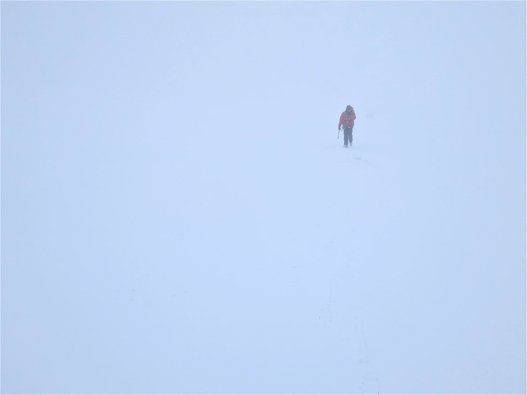 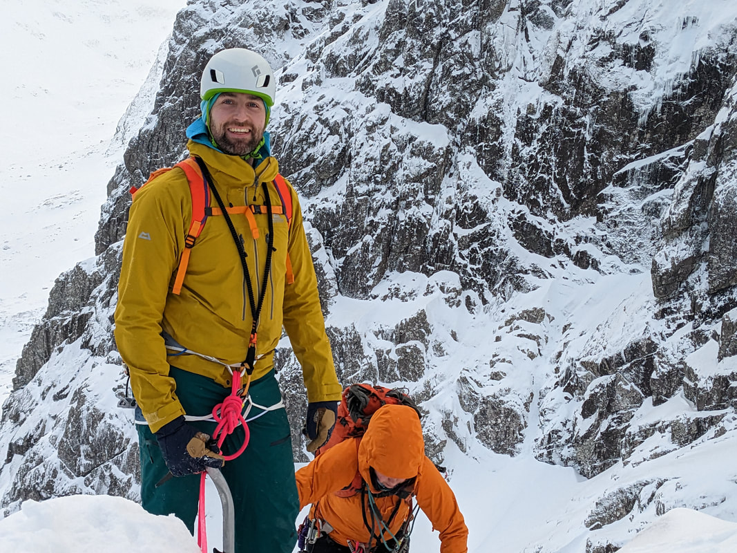 Tom was lucky enough to book onto one of our Classic Winter Climbing trips and end up being by himself for the week. This is less sociable of course but has meant that we can do just about whatever he wanted. Luckily, Tom wanted to explore the mixed up world of mixed climbing, lucky because there has been a lot of snow, continuous low temperatures and a persistent Considerable avalanche hazard. We need snow-thaw-freeze cycles to form snow-ice in our classic climbs. We have the snow and the freeze but without the thaw periods the snow has not transformed into ice or settled down into stable snow. So, it would have been all mixed climbs on buttresses anyway. 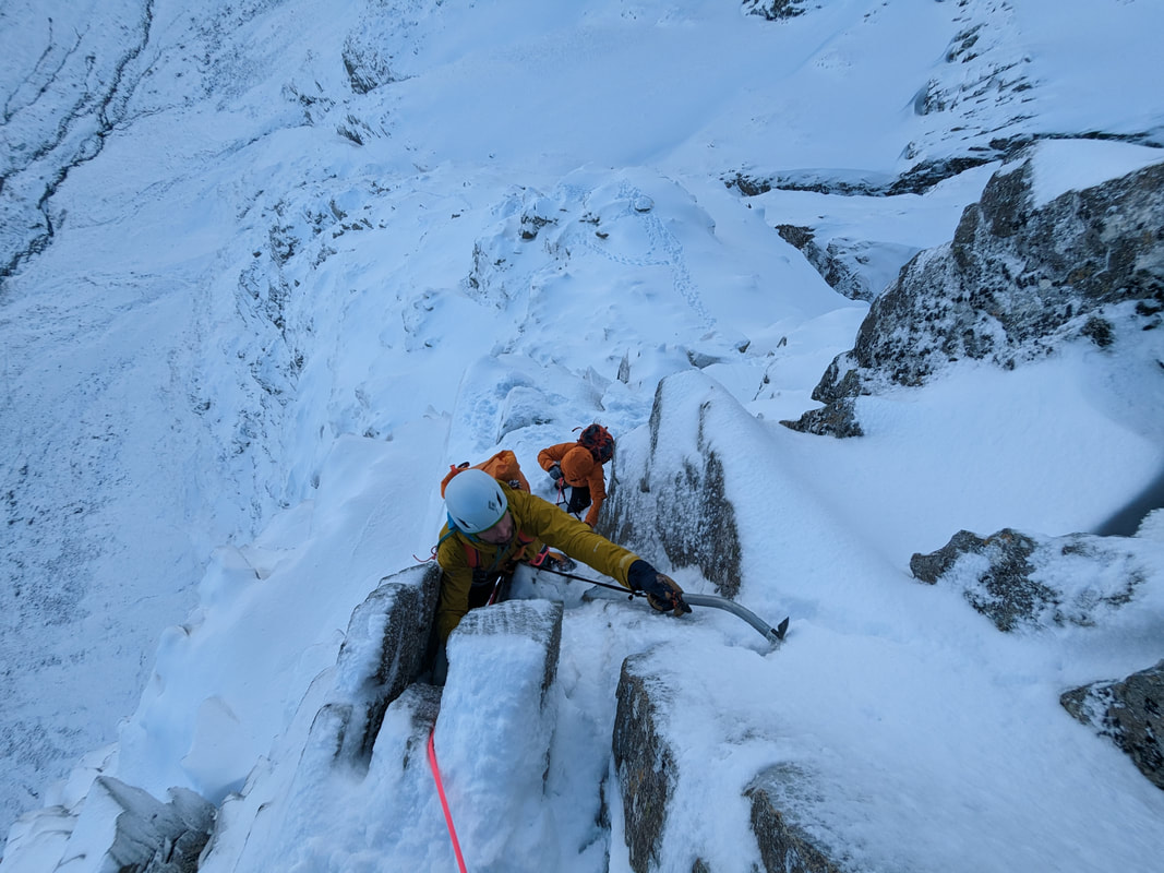 Rachael joined us on Monday and we started with Castle Ridge. This grade III is a classic ridge on Ben Nevis but it has a very distinct crux pitch in a steep chimney. With two ice axes and some comfort in hooking them into cracks and around chock-stones, this pitch can feel secure and fun to climb, but it is also incredibly exposed, awkward and pretty tough for many grade III climbers. We had a lovely day and we were suspicious of the snow everywhere, but we went up to Carn Dearg and descended Ledge Route back down into Coire na Ciste. Above 900m or so, there is a lot of snow and everything is very well filled in, so walking down Ledge Route was nice. 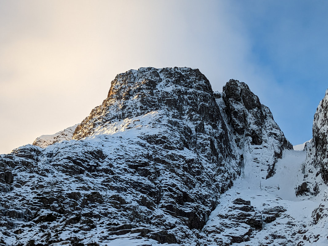 Tuesday took us to North Buttress on Buachaille Etive Mor. This is a fantastic climb with a very good ratio of walking to climbing. Seven pitches of climbing up the continuous line of chimneys got us to the walking section to the top. This is another rocky mixed climb that can build a bit of snow-ice, something that does change the grade, just the style of climbing. There was a bit of useful snow but also lots of hooking in cracks and teetering on little ledges with front points. Precision and accuracy are required more than strength - there is very little swinging of ice axes in rocky mixed climbing, just lots of scraping and searching for good hooks. 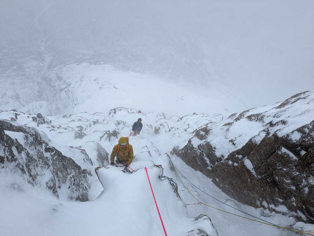 North Buttress is a popular climb and we enjoyed the company of three other teams on the climb. On Wednesday we went to where we knew there would be nobody else. In fact we didn't see anyone from leaving the van to getting back to it. We went to the West face of Aonach Beag where we climbed Raw Egg Buttress on the crag of the same name. Tom is very fit which is just as well - this is not a roadside crag. Three hours of rough ground, crusty snow and wading through deep drifts of fresh snow got us to the climb. 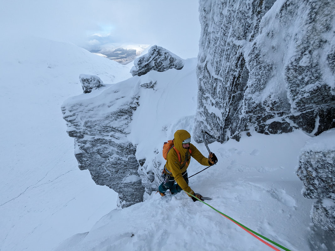 Raw Egg Buttress is an icy mixed climb, requiring a bit of ice in the grooves. We found plenty of ice, some snow-ice as well as some little bits of cascade ice that had formed from dribbles of water on the route. The buttress is a broken mass of pinnacles, blocks, walls and grooves. Punchy moves were separated by easy sections that benefited from the snow-ice. The last little wall was particularly spicy, with protection far below and a steep pull on dods of turf and nothing very much for the feet at all. The wind was blowing us up the wall but it also blew snow into our faces so we could not see very much and our eyebrows and lashes got well rimed up. Beautiful views from the top made up for the misty walk in and we got a great feeling of being out in the wilds in wild weather.  Not being afraid of a chunky walk in, today Tom and I went to Church Door Buttress. This a fabulous place for mixed climbing, home to some of the best and most charismatic climbs in Scotland. We had great fun in Western Chimney where we found lots of very helpful snow-ice, and lots of snow in general that had been blown up into the chimney. The crux overhangs quite considerably so this snow was no use there and we decided that we should bring more forearms next time!  We climbed up to the Great Arch enjoying the icy mixed climbing and cool moves. Protection is quite well buried or covered up in rimes, and then quite hard to dig out. Cracks are well iced up, but there is a lot of useful snow. This was Tom's first visit to Church Door Buttress so, to give him a feel for the place, we abseiled off the arch into Central Gully. This is 60m of vertical ground down under the arch, looking into Crypt Route all the way down. It's a very exciting abseil! Tomorrow will be a beautiful day with lots of sunshine and lighter winds so I think we will go back up Ben Nevis for another ultimate classic ridge. 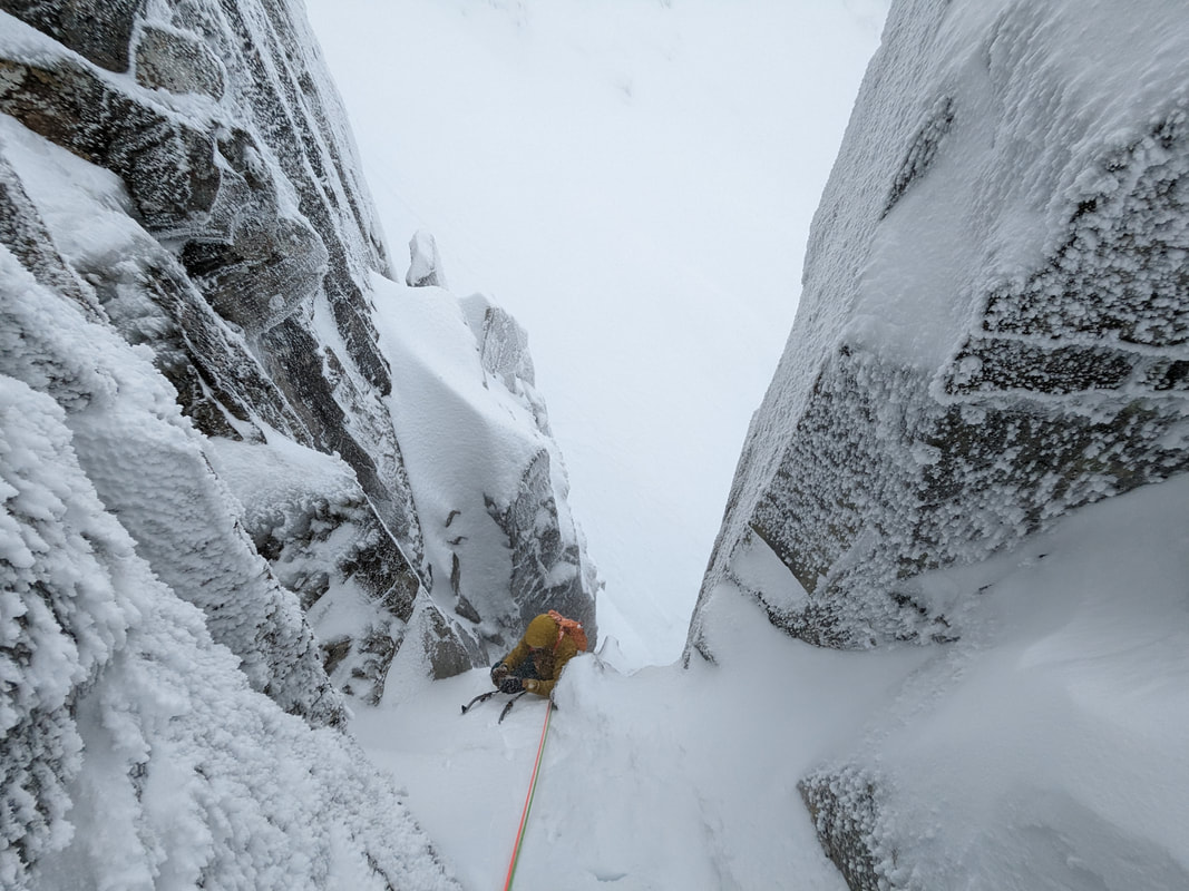 This spell of cold weather will end on Saturday. We have a few days of thaw forecast from Saturday afternoon along with some light rain at all levels. This will make route choice quite tricky at the weekend and it might trigger some of the windslab to avalanche. After a few days the avalanche hazard will reduce again, especially when we return to colder weather. Hopefully some of the fantastic cover of snow we have now will turn into ice on the climbs and bring some ice routes into good climbing condition. So far, it is shaping up to be a very good winter for climbing. We have space on our Classic Winter Climbing trip in March (13th to 17th March) as well as availability for private guiding in the week of 6th to 10th March. Get in touch if you'd like to book either of these. 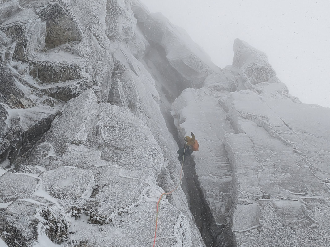 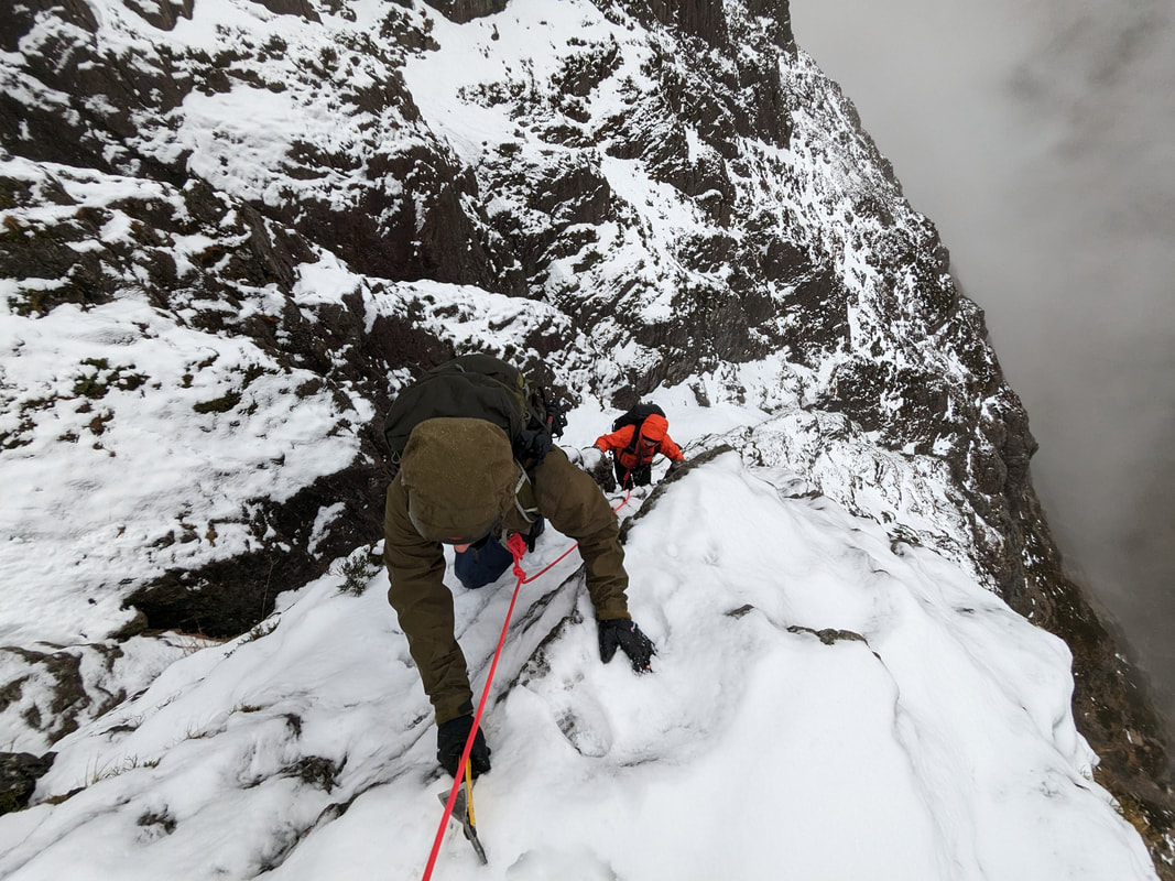 This week has been very much like January on the west coast of Scotland should be - cold, wet and windy. Each day, Richard, Phil and I have come back soaked, battered and exhausted. Each evening we have dried out all our gear ready to do it all again the next day. Winter climbing is a strange game. 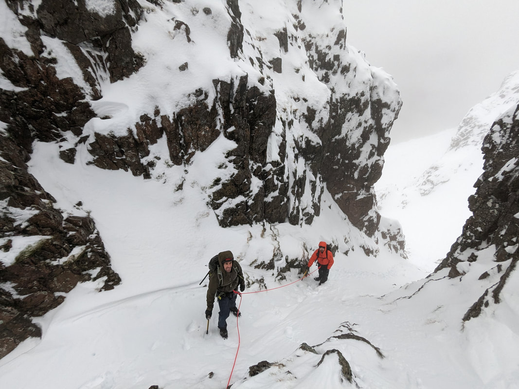 We started out on Tuesday with Curved Ridge. This was actually lovely and we had some nice views. The ridge was well covered in snow and the wind was not as strong as forecast. The temperature did rise to above the summits though so we got pretty wet on the way down. We were talking about avalanches, snow transportation and signs you can see as you go along. The sastrugi you can see in the picture above are the lines formed by the wind scouring away snow and putting it down somewhere else. This is an indicator that this particular slope is more becoming more stable. 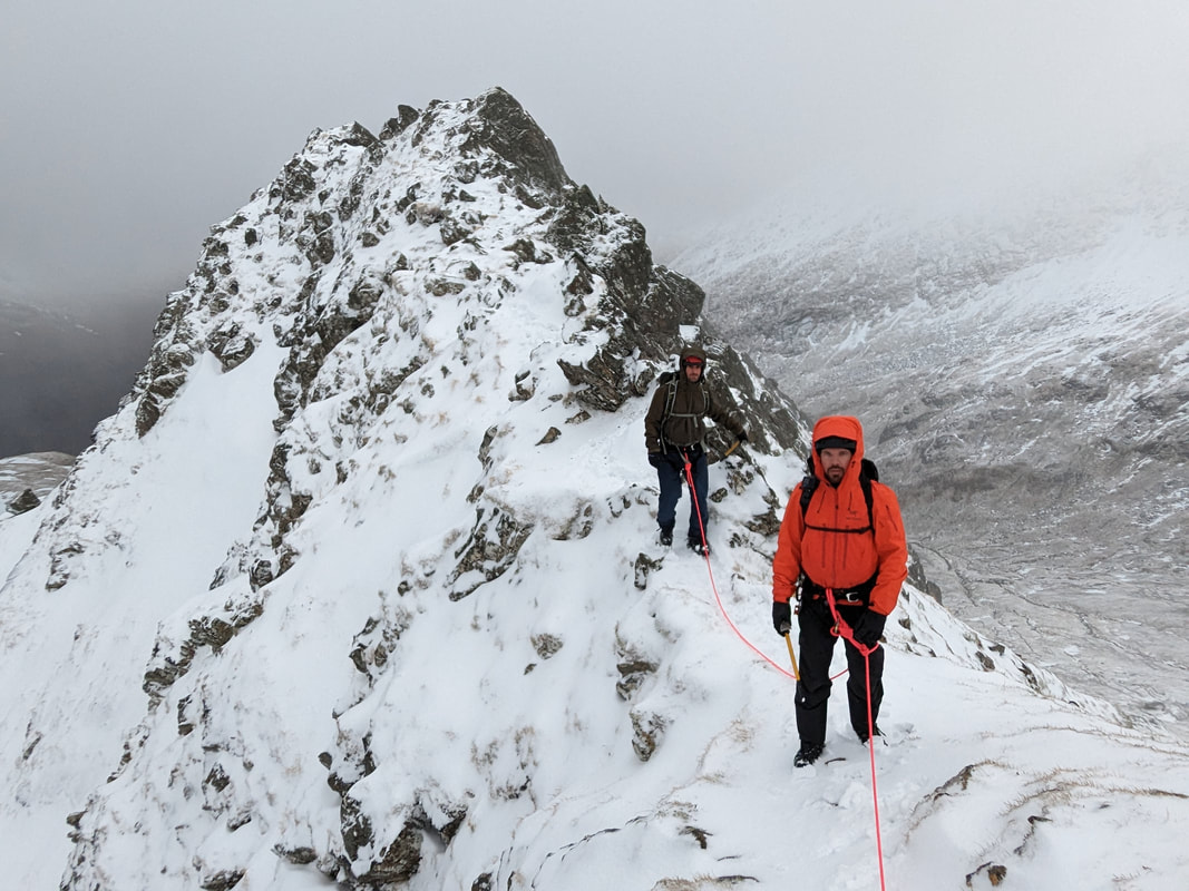 Yesterday we drove over to Glen Shiel where we climbed the Forcan Ridge. This spectacular, long ridge is a fantastic expedition that goes over a few tops before arriving on The Saddle. We moved together in alpine style for the whole climb, placing protection in the form of slings on blocks and through threads, and weaving around blocks on the ridge to act as anchors on the rope for us. There is also a cool little abseil that adds a bit of spice. Gusty winds and fast moving showers and clouds made it very atmospheric. 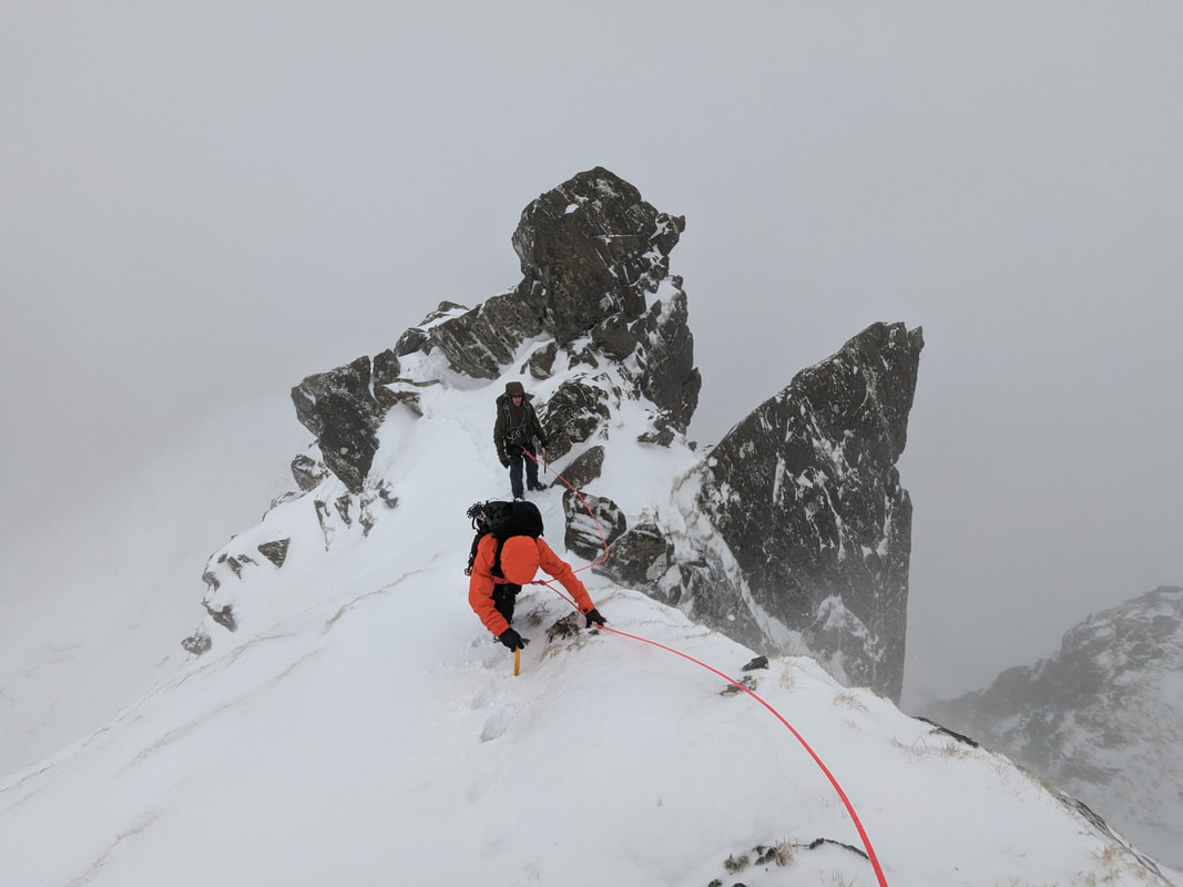 Today we went up Ben Nevis for another soaking. We climbed The SW Ridge of Douglas Boulder to nudge the technical level a bit higher and try out climbing with two ice axes. It was pretty well buried in snow so we didn't see many of the hooks that we pulled on, but we got an idea of mixed climbing. Ben Nevis above the CIC Hut is a very white place right now. Lots of snow has built up over the last few days with the freezing level going up and down a bit to lock the snow in place. An icy crust on the snow gave us the confidence that the snow we were on was not going to avalanche and the descent down East Gully of Douglas Gap was wind blown so little of the fresh snow that fell during the day had collected there. 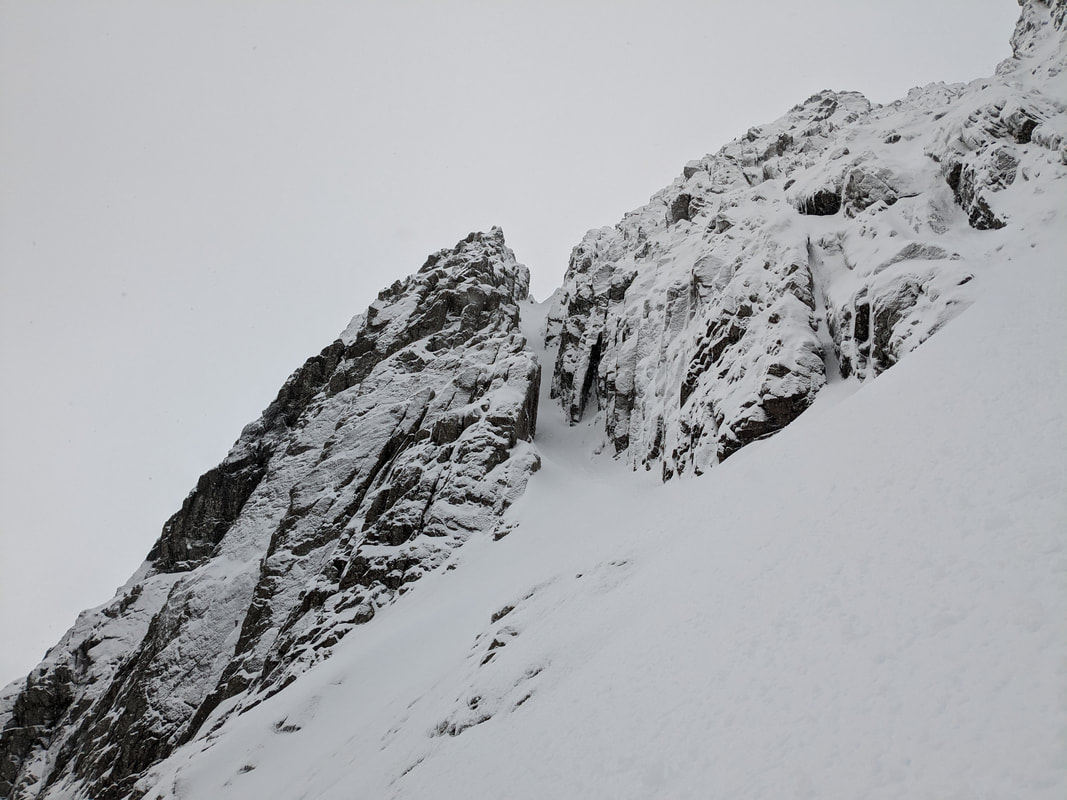 If you want to go climbing at the weekend, you should be a bit cautious with the snow. Avoid the gullies and stick to ridges and buttresses would be good advice. There is a lot of snow in the gullies and we saw one avalanche today and the debris of a second. The snow will take a while to transform into good ice for climbing on. There is still some ice around - Vanishing Gully looked fully formed, but it is hard to tell when there is so much snow on top of the ice, and this is where we saw an avalanche come down! The buttresses are very white with rime and snow so if you choose a crag that faces the wind (where most of the snow has been blown off) you will find some good climbing. Turf is frozen above 1000m. Tower Ridge would be a bit of a wade digging a trench through the snow, so try and go second and let someone else enjoy the hard work! 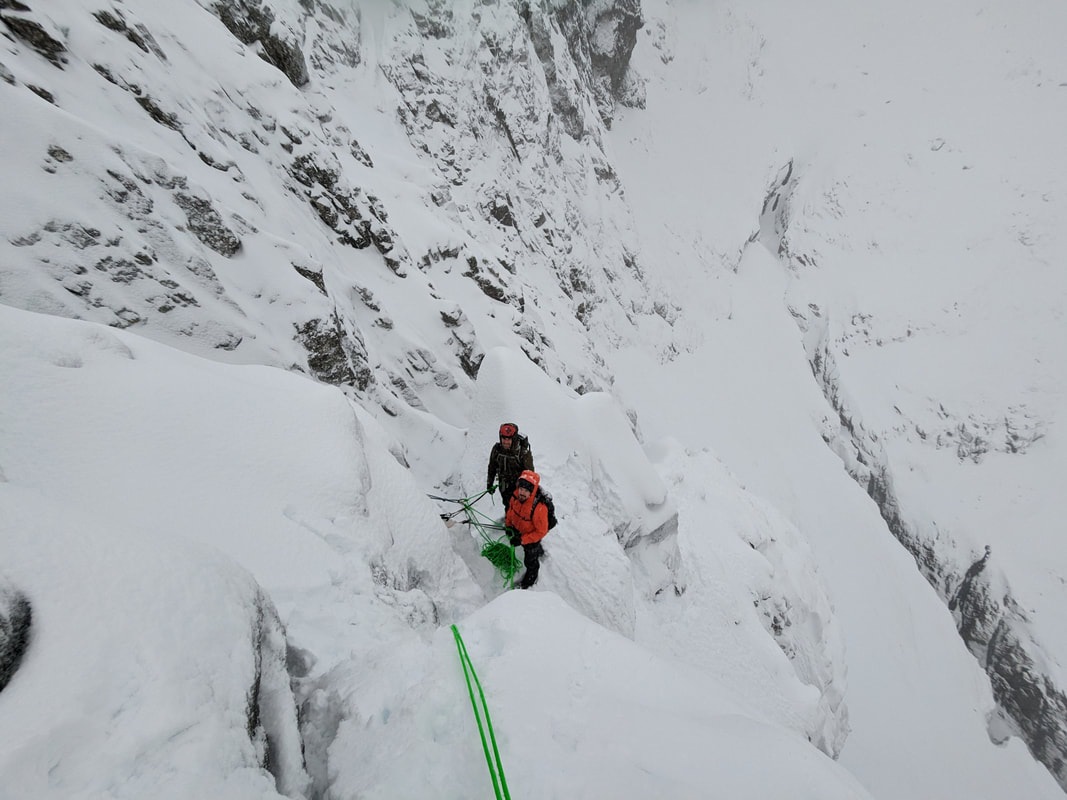 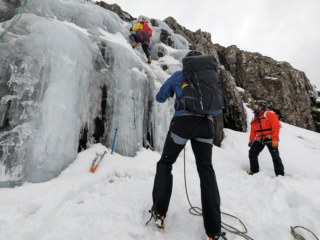 Snow has been building up nicely over the last week. On the west coast we have had a good amount of snow, down to the roads on a few occasions, interspersed with quite quick thaw freeze cycles. Snow - thaw - freeze cycles are great for locking snow in place and building good climbing conditions. We are still in the building phase, but it is looking promising. The outlook weather forecast looks OK as well, with mixed weather but generally cold for the next couple of weeks. After the Christmas feast it was nice to get back out again to burn off some extra calories, especially to find some snow and ice around to play on. This week I have been delivering an Intro to Winter Climbing course with Laura, Simon and Kenny. 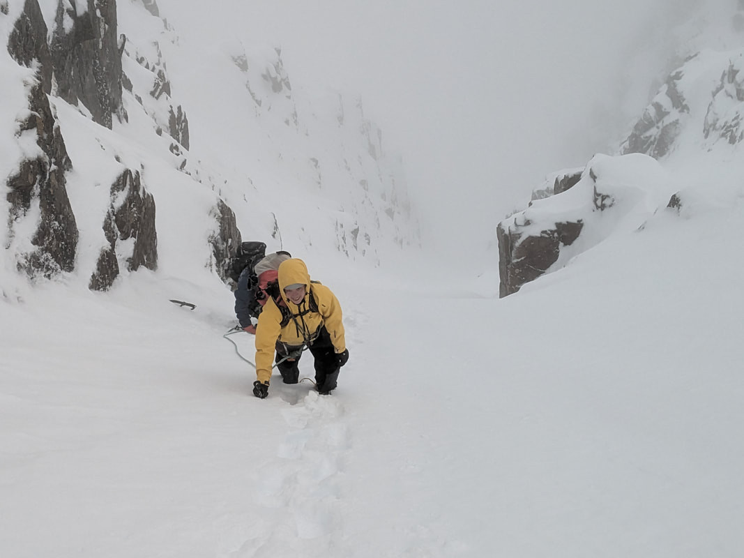 Yesterday we went to Stob Coire nan Lochan where we found a nice little ice cascade. We placed some ice screws and climbed the ice on a top-rope before walking round into Broad Gully. Buried axe anchors got us up Broad Gully with a stomper at the top, the first graded winter climb for the team. Today we took it to another level by climbing Curved Ridge. This now has quite a lot of fresh, soft snow on it which made the climbing quite insecure. Handholds were buried but the snow was useless for ice axes. Foot ledges were also hidden, so it was all a bity tricky. The team took it in their stride though and we topped out into very strong westerly winds. It was a battle to get down to the top of Coire na Tulaich and we had to be careful with the build up of fresh snow at the top but we got down into the coire and out of the wind.  Rannoch Wall was plastered in snow today and it would have been a good day to climb Agag's Groove or Engineers Cracks. The turf is well frozen above 600m or so. So, mixed climbs that do not need any ice are pretty good to climb right now. There are a couple of crusty layers in the snow which is not ideal since the thaw - freeze cycles this week were very quick (over night) so the snow has not been fully transformed into snow-ice. A few more, deeper thaw - freeze cycles will do a good job of bringing a few ice climbs into condition. 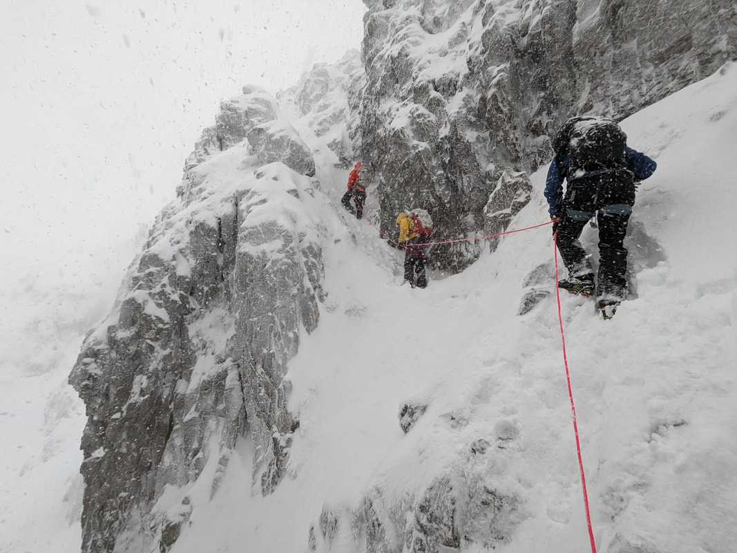 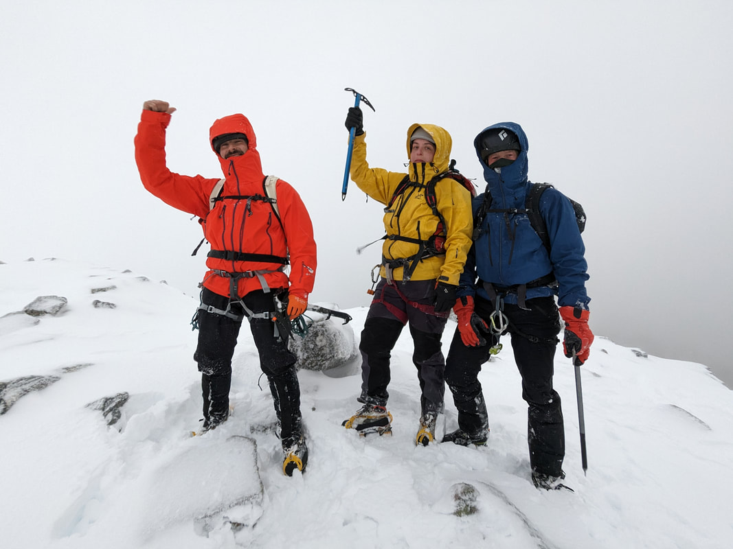 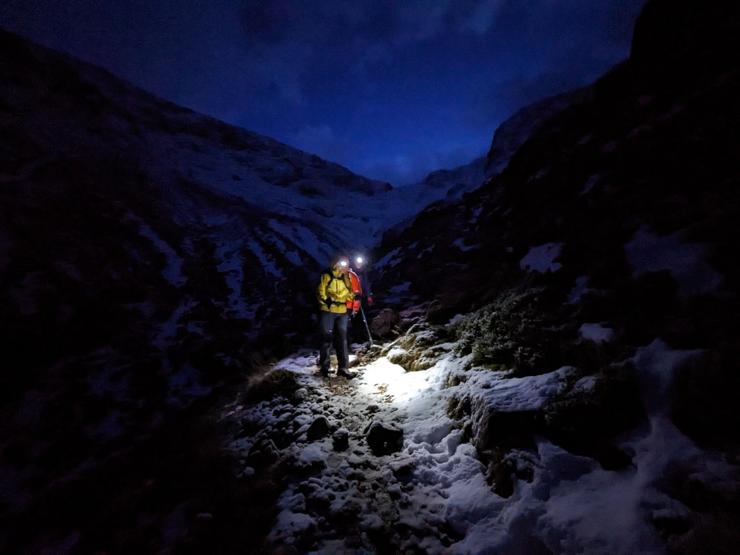 |
AuthorMike Pescod Self reliance is a fundamental principle of mountaineering. By participating we accept this and take responsibility for the decisions we make. These blog posts and conditions reports are intended to help you make good decisions. They do not remove the need for you to make your own judgements when out in the hills.
Archives
March 2024
|
 RSS Feed