|
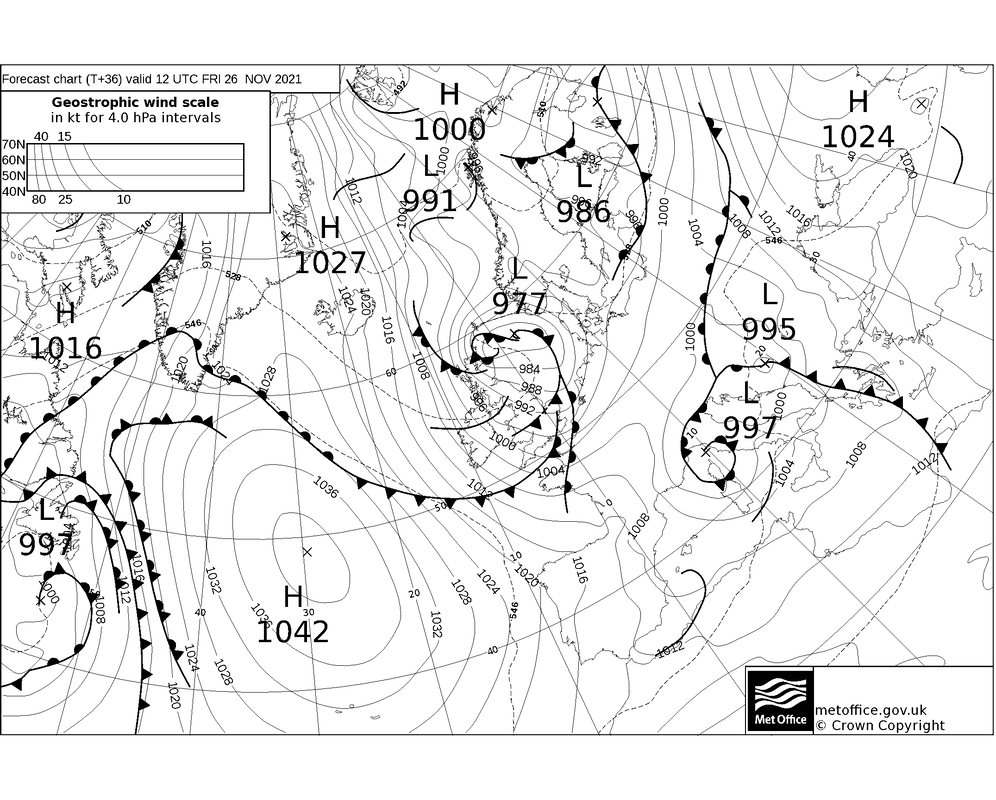
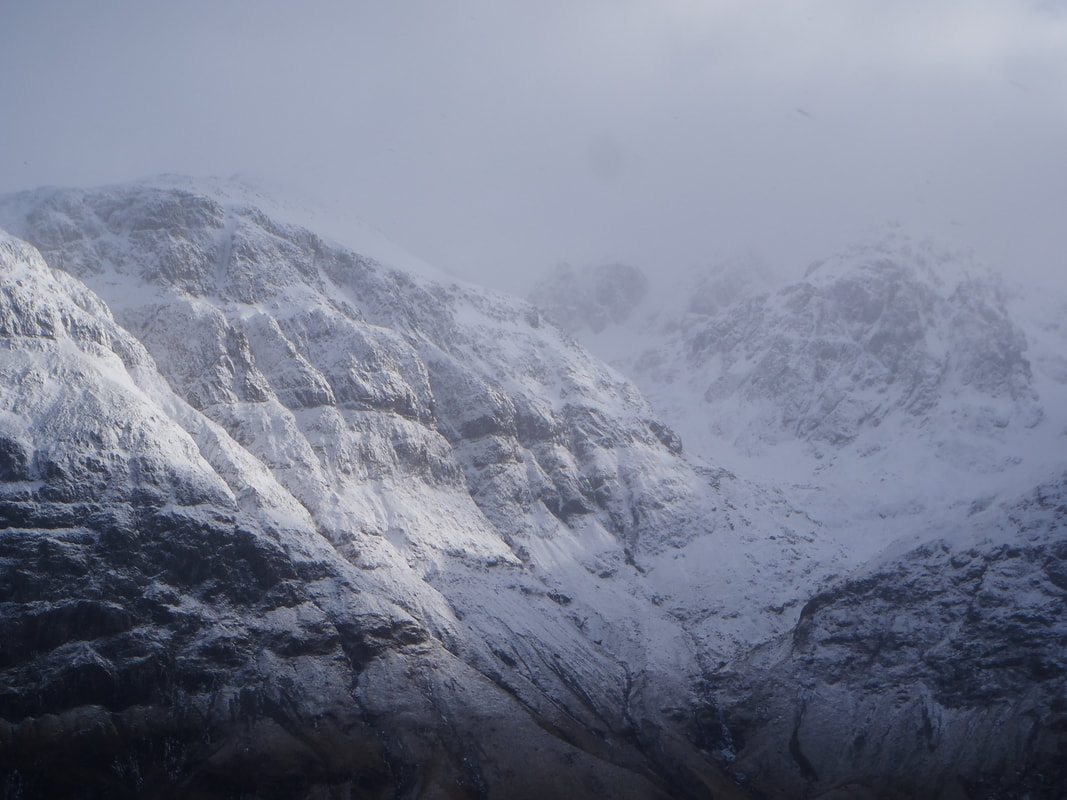
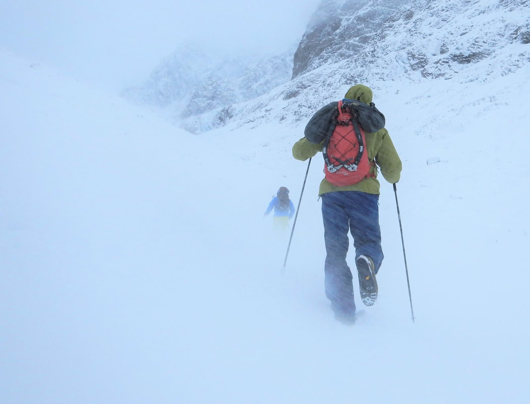
Over the last month the short cold spells have sprinkled snow onto the tops more frequently. It has generally been mild but with the slow cooling down that you'd expect with the days passing through October and November. Tomorrow is different. Our first winter storm will hit us from the north, bringing very cold temperatures, very strong northerly winds and lots of snow overnight into Saturday morning. Check out the forecasts on Met Office and Mountain Weather Information Service. With some simple understanding of synoptic charts, it is very easy to see what is going on. The low pressure in the North Sea (L 977) is a deep energetic depression with winds spiralling around it anticlockwise. The wind direction we feel at ground level is just about straight along the black lines called isobars. If you follow these lines, you can see they wiggle down onto us from the Arctic bringing very cold air. Tomorrow night the temperature at sea level will drop to freezing. Also, the lines are very close together. In the same way that closely packed contour lines indicate steep slopes, closely packed isobars indicate very fast moving air. Tomorrow night we expect 100mph winds on the tops from the north. There are also occluded fronts circling the low pressure. These are the black lines with triangles and semicircles on them and they mark boundaries of air masses at different temperatures. Where you see a front you will get precipitation, and this time, since it is so cold, it will fall as snow to quite low levels. Tomorrow is going to be a tough day in the mountains and it is only going to get worse over night! What does this mean for us? Well, 100mph wind will pick you up off your feet and dump you onto the ground a couple of metres away. An 80mph wind will knock you flat, a 60mph wind will make you stumble and brace against it and a 40mph will buffet you and knock you around, making walking hard work. It will be -7C on the tops and the wind chill in addition to this will make it feel like -20C when you are exposed to it. This is seriously cold. Any exposed skin will get very cold very quickly and become damaged if it is not covered up quickly. In the cloud and falling snow, it will be very hard to see where you are going. The ground will quickly turn white and blend into the sky so finding your way and navigating will be difficult. It will be very hard to look where you are going with the strong winds blowing snow and bits of ice into your face, unless you have goggles. Thankfully, it looks like the worst of the winds and snow fall will be overnight, and Saturday will give us 40mph to 50mph winds dropping away a bit during the day. Snow showers will blow through but we might get some bright spells in between the showers. If you want a burly, blustery day out in the mountains to test out your new kit and to blow away the cobwebs, you will have the opportunity at the weekend! I love burly autumn days like this, when you come home exhausted and blasted by the wind, thoroughly tested by our amazing mountains. It's my idea of a spa weekend, the thing that refreshes me and sets me up right for the week ahead. Make sure you take all your kit though - ice axes, crampons, goggles, map compass, big gloves, more big gloves, warm hat, flask of hot drink, energy, drive, determination and the knowledge of how to look after yourself in proper winter conditions. If you are into winter climbing, this bit of weather is good news. At the start of the winter, we need to wait until the ground cools down and freezes. Blocks need to freeze into place and turf needs to freeze solid to provide fun climbing and so that we do not damage the ground when we go climbing. Pulling turf off climbs is not cool.
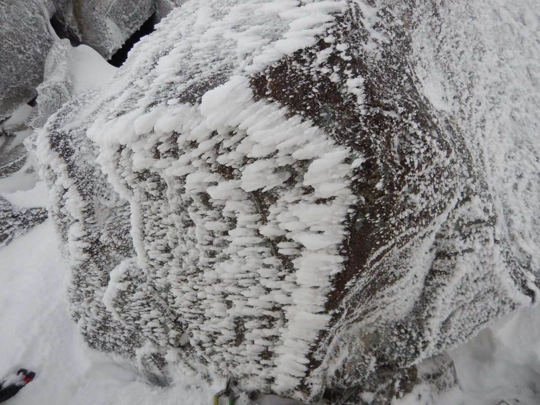
Wind chill effects the ground in exactly the same way that it effects us. The wind will whip away the heat in the ground soaked up by the rocks as they baked in the sunshine all summer. We need a good few weeks of very cold temperatures and, ideally, strong winds blowing onto the crags to cool them down and freeze everything solid. If everything gets covered in snow before the ground freezes properly, the snow insulates the ground and the turf and blocks do not freeze as quickly or as well. Wind blowing clouds onto rocks (or anything else) with a temperature below freezing will make rime grow. Rime ice is the feathery crystals of ice that grow into the wind and is what makes the crags white. Along with being frozen, this is the main requirement for mixed routes to be in suitable winter condition for us to go and climb them. So, the storm on Friday night is likely to rime up north facing crags up in the cloud and exposed to the wind. If you find something completely rocky and solid, you might well find good climbing. Take a big belay jacket though! Happy climbing!
0 Comments
Your comment will be posted after it is approved.
Leave a Reply. |
AuthorMike Pescod Self reliance is a fundamental principle of mountaineering. By participating we accept this and take responsibility for the decisions we make. These blog posts and conditions reports are intended to help you make good decisions. They do not remove the need for you to make your own judgements when out in the hills.
Archives
March 2024
|
 RSS Feed
